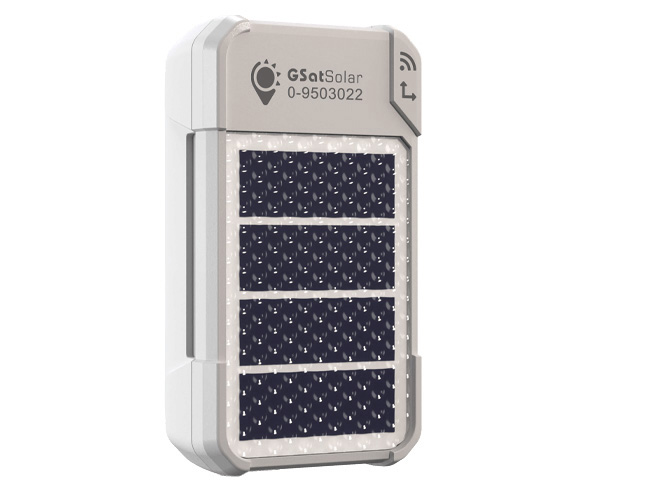
Solar Powered, Low-Cost Tracking Device
GSatSolar is a solar battery powered, lightweight, rugged IP68 device for remote asset tracking, IoT applications and livestock tracking. Now fully integrated with Cloudloop, which provides seamless access to tracking data, automated subscription management, and a user-friendly platform for monitoring assets in real time.
Designed for prolonged outdoor use and utilizing the Globalstar satellite network, GSatSolar is low cost, simple to set up and has a range of mounts for attaching to fixed or moving assets. The device can also communicate with wireless sensors using BLE technology to intelligently transmit the status updates of IoT enabled devices.
GSatSolar was designed to resolve the initial high costs often associated with asset tracking projects in remote areas, where there is no cellular network coverage and so a satellite-enabled solution is required. In addition, these remote locations often mean the tracking devices need to be battery or solar powered in the absence of mains power.
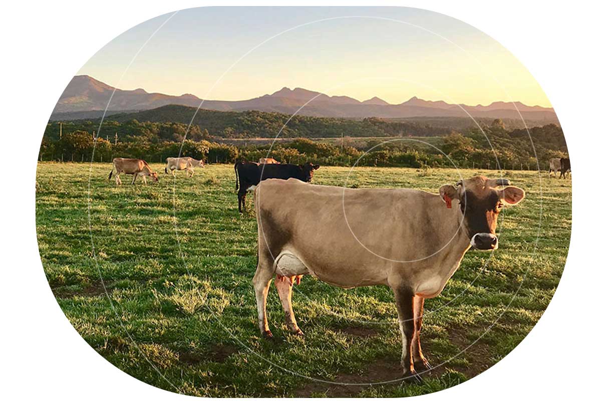
By optimizing the data that is sent via satellite into small packets, the low cost of the device coupled with a cost-effective Globalstar service plan, has enabled broad applications including tracking cattle by ranchers, adventure vehicles by holiday hire companies, unattended industrial equipment by construction firms, and endangered wildlife by conservationists and anti-poaching agencies.
Users also gain access to Cloudloop Subscription Manager to manage their airtime and device activation, Cloudloop Data to easily export correctly formatted data to a preferred destination, and Cloudloop Tracking to see a real-time and historical view of asset locations.
- Utilizes the Globalstar LEO Satellite Network
- Globalstar Simplex usage plans – single package messages = 9 bytes per message
- Powered by a solar panel which recharges the internal lithium polymer battery
- Full charge achieved in normal daylight conditions
- IP68 rated for use in harsh outdoor conditions
- Weighs just 30g, small enough to go unnoticed
- Precise GPS tracking and monitoring of assets, such as livestock, vehicles and equipment
- Integrated with Cloudloop Tracking, enabling live and historical locations, and event logging
- Supports geofencing, speed monitoring, and movement alerts
- Integrates with wireless sensors using BLE
- Three tracking modes: Standard Tracking, Motion Tracking and Dock Mode Motion Tracking
- Manage airtime and device activation using Cloudloop Subscription Manager
Satellite Communication
- Typical latency: 60ms
- Elevation angle: 52°
- Frequency: Tx: 1611.25 Mhz – 1618.75 Mhz
- EIRP: 25.82 dBm
GPS/Glonass/Beidou/Galileo
- Acquisition time: 1 second; Reacquisition: 2 seconds; Cold: 26 seconds
- Accuracy: 2.0m CEP
- Sensitivity: » Tracking & Navigation: -167 dBm, Cold starts: -148 dBm, Hot starts: -157 dBm
Certification
- Regulatory: CE, FCC, IC, IEC 62209-2.2010, CAN ICES-3
Battery
- Lithium Polymer
- Battery Capacity: 153mAh
- Battery charging temperature range -10 to +55°C
- Standby current: 30-40uA
- GPS on current: 50-60mA
- Transmitter on current: 500mA max @ 3.7V
Solar Panel Performance
- Solar Panel Power: 125 mW
- Charging Time: 5 hours of direct sunlight to fully charge from a dead battery
- 3 hours of direct daily sunlight to keep fully charged at 30 minute reporting rate
Dimensions
- 5.8 x 3.2 x 1.8 cm (2.25 x 1.25 x 0.70″)
Environmental
- Operating temperature: -20 to +65°C
- Dust and water ingress: IP68
Flash Memory
- Size of each data element: 12 Bytes (3 for Lat, 3 for Long , 4 for Timestamp & 2 bytes padding)
- Total number of data elements: 8.4 (years) * 365 (days) * 4 (Tx per day) = 12276 data points
- To determine how many days of locations are logged to the unit, use the following formula: 12276 / (reports per day) = (number of days logging)
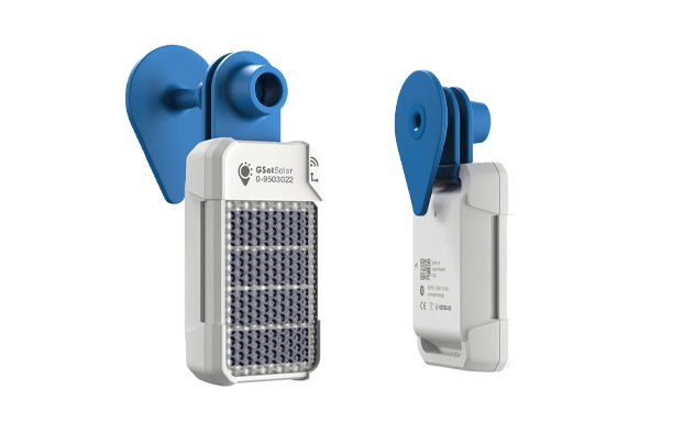
Mounting Options
- Multipurpose Clip: 5 grams (0.176 ounces)
- Strap
- Adhesive or 3M VHB tape
- Animal Ear Tag: 4 grams (0.141 ounces)


Can we help?
If you are planning a remote IoT and/or tracking application, and you’d like some advice on the best device and satellite airtime for your needs, get in touch! We have been delivering remote connectivity solutions for over 20 years, and design and build our own hardware. We also – as in this case – work with third parties when they have a great product, so we can always pair our customers with the right solution for their needs.
Complete the form or email hello@groundcontrol.com; we have offices in both the UK and USA, and we’re standing by to help.