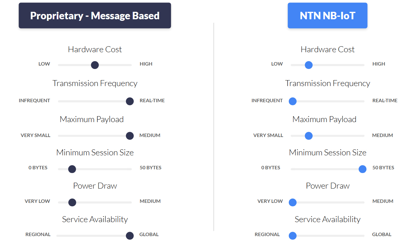
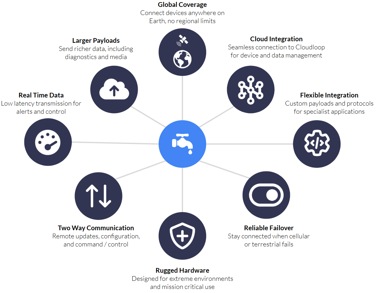
According to IoT Analytics, the global market for satellite IoT connectivity is projected to grow at a CAGR of 26%, reaching $4.7 billion by 2030. Currently, the satellite IoT market is dominated by proprietary modules – meaning that if you want to use Iridium’s SBD service, you need an Iridium SBD module. These modules and accompanying protocols have been tailor-made for satellite communication, and can move large data payloads quickly and reliably, making them perfect for critical IoT applications such as alerts, command and control, and critical infrastructure.
The growth projected by IoT Analytics is anticipated to largely come from standards-based, rather than proprietary, IoT connectivity. This means using standards built for cellular to move data over satellite, so you can use the same chipset that you would use for cellular NB-IoT to access non-terrestrial NB-IoT (in this context, satellite-based connectivity is almost always referred to as NTN – non-terrestrial network). Analysts believe that the lower cost of modules, ability to switch suppliers, and extremely low power requirements will facilitate new, massive IoT applications.
That said, the cost of manufacturing proprietary modules – which have historically commanded a higher premium – is falling, as scale manufacturers like u-blox and Quectel have started to produce these at a much lower cost. Any massive IoT application which is not latency-tolerant, and/or needs to move larger volumes of data, will have options to explore in the proprietary module space, too.
In this blog post, however, we’re exploring NTN NB-IoT in detail, with the goal of helping systems integrators and network architects evaluate whether this emerging technology will suit their remote connectivity application.
What is NTN NB-IoT?
NB-IoT, or Narrowband Internet of Things, is a cellular technology standardized by 3GPP Release 13 in 2016. It was specifically designed for the Internet of Things. NB-IoT falls into the category of Low Power Wide Area Network (LPWAN) technologies. LPWAN technologies are tailored for devices with specific requirements, distinct from smartphones or mobile broadband connections. Key characteristics include:
Small Data Amounts
Devices are designed to send relatively small amounts of data, typically a few bytes or kilobytes, infrequently. This is suitable for simple sensor data or control commands.
Long Battery Life
Due to minimal data transmission and optimized radio usage, these devices are built to operate for extended periods on battery and/or solar power, often for several years.
Low Hardware Cost
LPWAN technologies typically have low cost hardware costs, which is essential for IoT deployments involving hundreds or thousands of devices spread over large geographical areas.
Wide Area Coverage
LPWAN technologies offer long range, low power, small packet connectivity over extensive areas, enabling huge numbers of devices to run for years on a single battery.
NB-IoT achieves these goals by using a subset of features from traditional LTE cellular technology, operating within a narrow slice of the radio spectrum (80 kilohertz bandwidth). This narrow bandwidth and simpler protocols are key to power efficiency and low cost, reducing the complexity and power consumption of the device’s modem. However, terrestrial NB-IoT devices can only send data in areas with reliable cellular coverage.
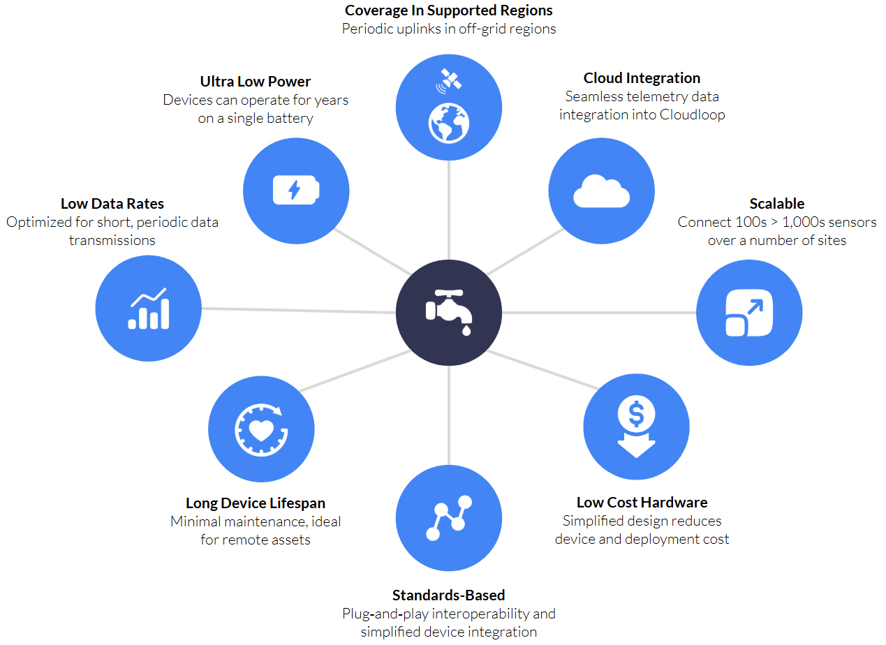
Non-Terrestrial Network Narrowband IoT (NTN NB-IoT) combines NB-IoT’s low power, low cost cellular technology with satellite communication, enabling devices to connect via satellites in addition to, or instead of, terrestrial towers.
NTN NB-IoT will, when fully mature as a technology, enable global IoT deployments, for projects involving large numbers of simple, low power, low data devices spread across remote areas and across borders. It extends the benefits of NB-IoT beyond its terrestrial limitations, delivering (depending on the satellite network) up to 100% global coverage.
What are the Benefits of NTN NB-IoT?
In addition to being extremely power efficient, the key benefits of cellular NB-IoT is that it operates in licensed spectrum controlled by Mobile Network Operators (MNOs) and standardized by 3GPP, which offers dedicated capacity, more flexibility in the cellular network for switching and roaming, and multi-vendor support for devices and network infrastructure.
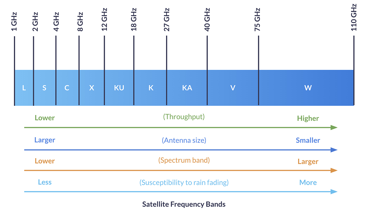
NTN NB-IoT similarly operates within licensed spectrum, in this case, controlled by Satellite Network Operators (SNOs) like Viasat and Iridium. It is actively being standardized within 3GPP; initial support for NTN was introduced in Release 17, and Release 18 (launched mid-2024) is significantly advancing NTN integration into the 5G system. It uses a narrow spectrum of the L-Band, S-Band and Ka-Band frequencies, allowing IoT devices to communicate with LEO, MEO and GEO satellite constellations.
Mobile IoT devices equipped with NTN NB-IoT modules can move from terrestrial networks to satellite networks without needing to use a proprietary module. This means IoT devices can be built with a single chipset that delivers NB-IoT connectivity over both cellular and satellite networks, reducing hardware costs because of production economies of scale.
As noted earlier, proprietary modules are also set to benefit from these scale economics, as large chipset manufacturers like u-blox and Quectel are adding the production of these to their portfolio. A key distinction, however, is that a proprietary module will only allow you to connect with one satellite constellation, whereas an NTN NB-IoT module could connect to any satellite network that supports NTN NB-IoT, which could reduce airtime pricing thanks to competition. It will be some years before there is adequate coverage for this to be realized, however.
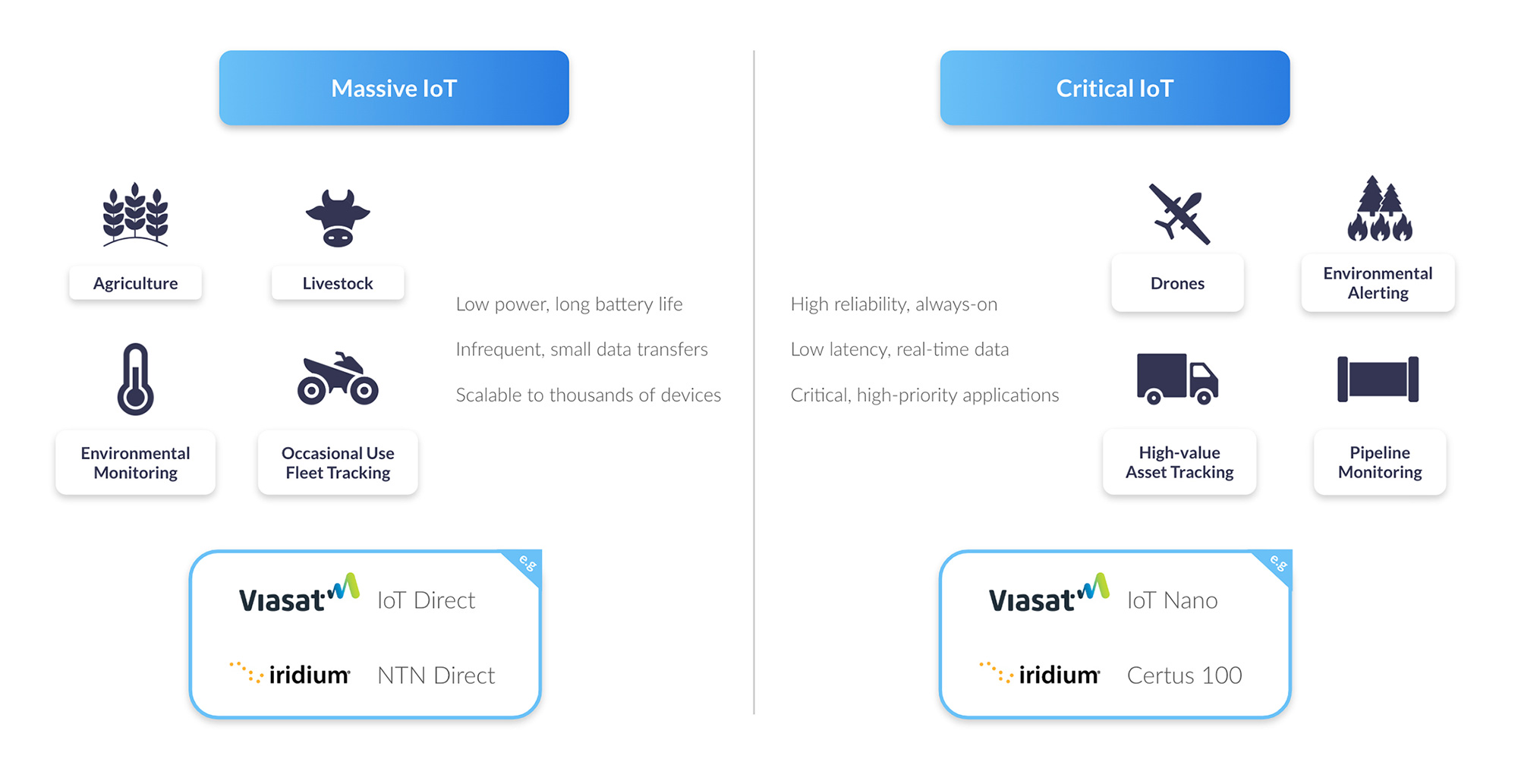
The promise of NTN NB-IoT lowering the cost of satellite connectivity has the potential to unlock new massive IoT applications in fields such as environmental monitoring, agriculture, and global asset tracking.
Challenges for NTN NB-IoT
Like its cellular counterpart, NTN NB-IoT is designed for large scale, battery-powered deployments. However, communicating with a satellite using a standards-based module, rather than a proprietary satellite modem, brings a new set of technical and economic challenges to overcome.

Higher Latency
Increased Battery Usage
Antenna Positioning
Coverage
Costs
Network Congestion
Lower Data Rates
Data Optimization for NTN NB-IoT
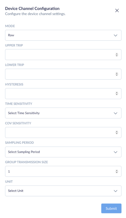
For remote NTN NB-IoT applications, sending occasional small data packets becomes essential to reduce signaling duration and battery energy usage, as well as to minimize costly per-byte satellite usage.
When it comes to selecting how data is transferred, there are two options provided by the key players in the industry: IP and Message-based protocols. And to meet the data constraints of remote NTN NB-IoT applications, these protocols become a choice between UDP/IP and NIDD (Non-IP Data Delivery).
Here’s an example to highlight the differences between UDP/IP and NIDD data packet sizes.
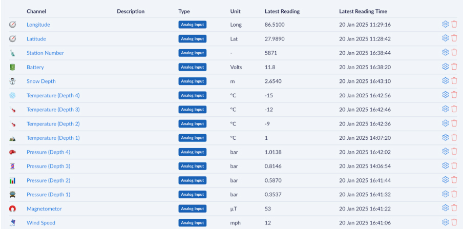
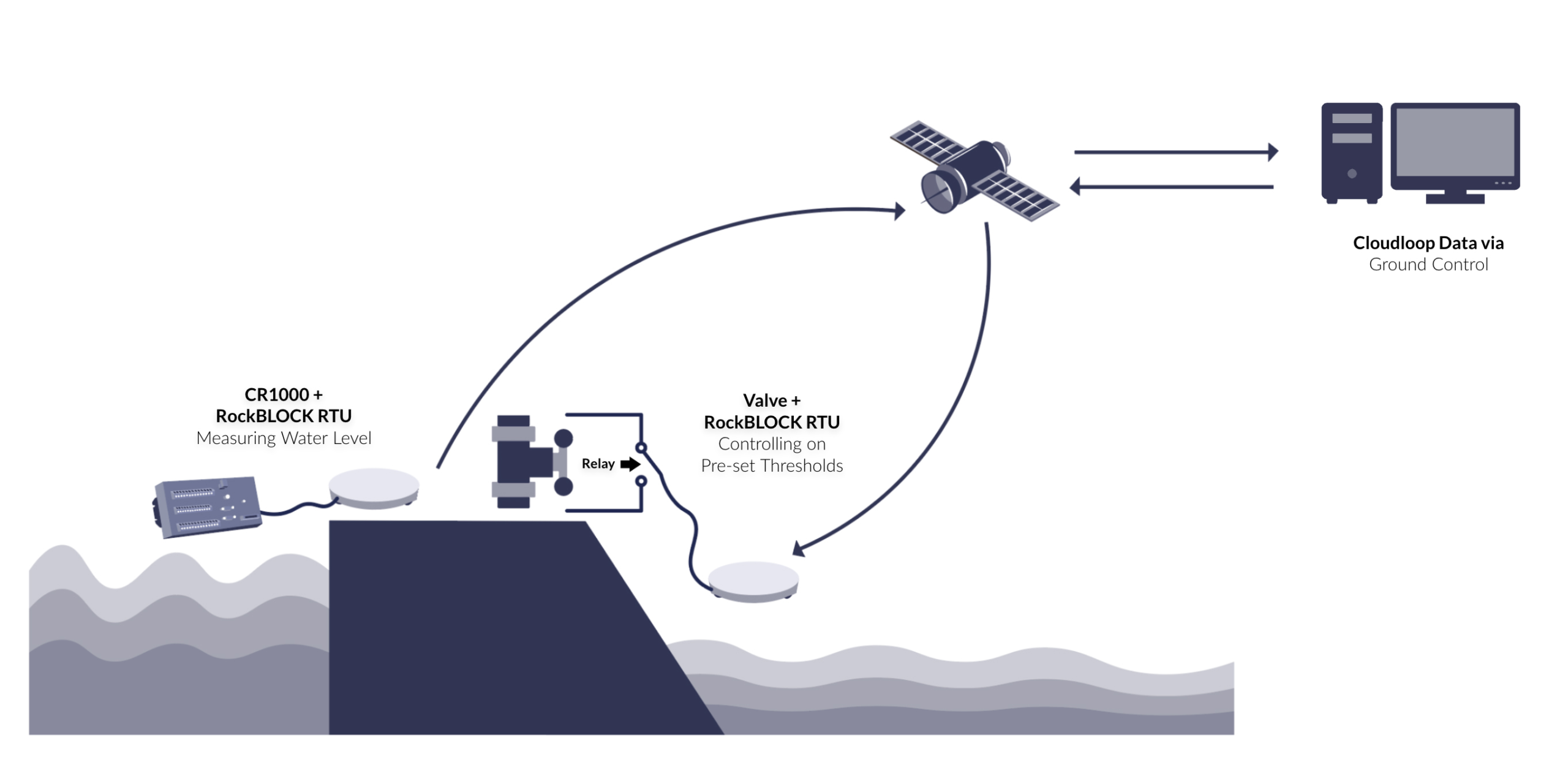
A simple water level sensor is sending a status reading and the raw data is 18 bytes long. On top of that, the application running on the device is using CoAP (Constrained Application Protocol), which adds a 4-byte header. This creates a payload of 22 bytes of application data.
To send this message using a traditional UDP/IP stack, the IP and UDP headers add a further 28 bytes, resulting in a total packet size of 50 bytes. By contrast, using NIDD the message is transmitted without any IP or UDP headers, so the total packet size remains just 22 bytes. This efficiency makes NIDD particularly well suited to low-power, low-data IoT devices operating over NTN networks, where every byte of airtime and every milliwatt of battery power matters.

So, the case for using NIDD for NTN NB-IoT is that it reduces the size of data packets to be sent to the satellite, and therefore reduces satellite byte costs, while drawing less power. However, the key benefit of UDP/IP is that the same IP address can be used when moving between cellular and satellite, which is useful for applications which cover devices moving in and out of cellular range, such as maritime vessels or pipeline monitoring.
Comparing UDP/IP and NIDD Benefits
Depending on their agreement with the SNO, some NTN NB-IoT service providers will be offering UDP/IP and/or NIDD solutions, and there are benefits and drawbacks to both. Here is a comparison table to highlight the key differences between each method of data transfer.
|
UDP/IP over NTN NB-IoT |
NIDD (Non-IP) over NTN NB-IoT |
|
|
Protocol Overhead |
IPv4+UDP adds 28 bytes header per packet. Some NTN offerings bill with a 50-byte minimum that includes this IP/UDP header. |
No IP/UDP header; payload is carried on signaling (control-plane), avoiding the 28-byte IP/UDP overhead of UDP. |
|
Power Consumption |
Higher than NIDD for tiny, intermittent messages because you transmit extra header bytes and maintain an IP data session. |
Lower for small, sporadic messages by eliminating IP overhead and using signaling paths designed for low power. |
|
Integration |
Easier for standard IP apps; minor firmware/backend changes may be needed. |
Requires SCEF/I-API support and backend changes to map messages to your application. |
|
Security |
Runs over the Internet path; secure with DTLS/TLS and/or VPN. NAT/VPN commonly recommended for inbound traffic. |
Data doesn’t traverse the public Internet; operator exposure functions provide an extra security boundary. |
|
Roaming |
Single IP address when moving terrestrial ↔ satellite. |
Satellite‑only: no IP address for cellular roam; each uplink uses the NTN pathway. |
|
Best For... |
Applications that move in/out of cellular coverage (e.g., maritime, logistics). |
Ultra‑low data, stationary sensors where minimizing airtime and power is paramount. |
Cost & Minimum Payload Considerations
The economics of NTN NB‑IoT hinge heavily on each provider’s minimum supported packet size. Today, Skylo enforces a 50 B floor (including headers) on every UDP/IP message, effectively eliminating NIDD’s payload‑size savings until true NIDD support arrives. Likewise, Sateliot offers standard 3GPP Rel‑17 NB‑IoT over satellite (UDP/IP only) and hasn’t published any reduced‑overhead or NIDD option, so ultra‑small packet users are forced into that same ~50 B envelope.
Until more satellite operators clarify their packet‑size limits or introduce truly NIDD‑capable services, many “tiny telemetry” applications will find themselves priced out of the savings NIDD could otherwise deliver.
The first full NIDD offerings won’t arrive until H1 2026, when Viasat NB-NTN launches its satellite‑only NB‑IoT SIM, complete with both UDP/IP and NIDD modes. Shortly after, Iridium NTN Direct – built on 3GPP Release 19 NTN enhancements – will also bring standardized NIDD support (devices expected in 2026).
In the meantime, proprietary satellite‑IoT networks such as Iridium SBD and Viasat IoT Nano bill in 10 B increments, making them the only current options for truly tiny, cost‑efficient uplinks – albeit at the price of custom hardware and vendor lock-in.
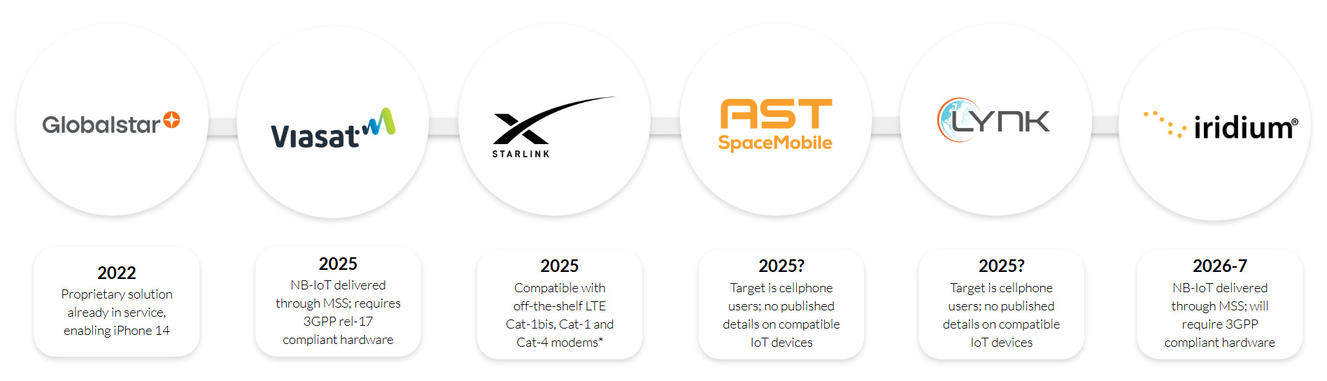
NTN NB‑IoT Service Timeline
Early 2024 – Summer 2025
- Skylo rolls out its Release 17-based service (UDP/IP only) via partner MNOs across the United States, Canada, Brazil, Australia, New Zealand and select European markets
- Sateliot operates a demo LEO fleet for Rel 17 NB‑IoT trials; today’s service is UDP/IP only, with no published NIDD option.
H2 2025 (Pilot & Dev Kits)
- Viasat NB-NTN appears in partner POCs and developer previews (e.g., Ground Control’s Cloudloop integration), with two way NB‑IoT over L‑band. UDP/IP today, NIDD to follow.
H1 2026 (Projected Commercial Launch)
- Viasat NB-NTN full release: satellite‑only NB‑IoT SIM supporting both UDP/IP and NIDD payloads
- Iridium NTN Direct enters commercial service built on 3GPP Release 19 NTN enhancements (including standardized NIDD support).
Will NTN NB‑IoT Open New Markets for Satellite IoT?
NTN NB‑IoT holds clear potential to bring truly global, low‑power IoT to industries unable to leverage terrestrial networks; think widespread environmental sensing, remote infrastructure monitoring and asset tracking in the world’s most isolated regions. However, two pivotal commercial variables will determine how far it can go:
- Cost per Byte & Minimum Packet Size: Until services offer sub‑30 B NIDD payloads at competitive rates (versus today’s 50 B UDP/IP floors or proprietary 10 B options), many micropacket use cases will remain marginal.
- Network Capacity & Congestion Management: Supporting massive fleets of devices over narrow satellite channels requires robust scheduling, interference mitigation and priority handling – features still under development in Rel 17/18 NTN specs and vendor implementations.
Importantly, NTN NB‑IoT does not replace today’s proven proprietary services; it adds to the IoT toolbox. Solutions like Iridium SBD/IMT and Viasat IoT Nano will continue to serve critical, higher throughput or low latency applications, where SLAs, two‑way command/control and strong QoS are non‑negotiable. And, as discussed, the advent of scale manufacturers taking over the production of proprietary modules is set to bring down the cost of these services. NTN NB‑IoT, by contrast, unlocks a new class of latency-tolerant, very small data deployments of homogenous hardware across areas with a mix of cellular and satellite coverage.
Once Viasat NB-NTN and Iridium NTN Direct deliver standardized NIDD in 2026, expect a step‑change: low power, low cost satellite IoT scaling from niche pilots into planet‑wide solutions, while incumbent proprietary networks remain the go‑to for mission‑critical workloads.

Talk to Us About NTN NB-IoT
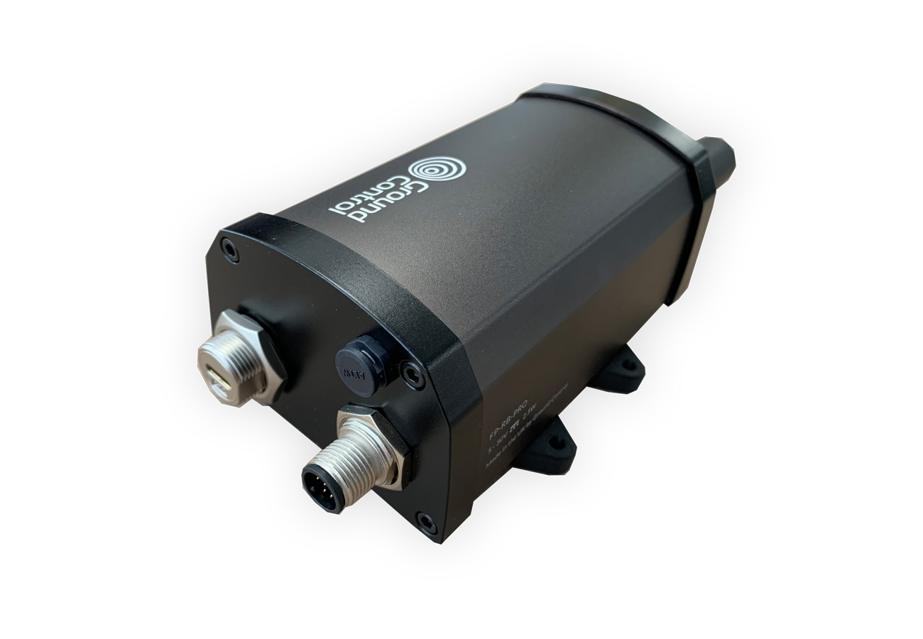
We’re experts in satellite IoT and asset tracking, and are actively working on new NTN NB-IoT enabled hardware and service integrations with our IoT platform, Cloudloop.
If you have questions about how NTN NB-IoT could enable your IoT projects, please email hello@groundcontrol.com or complete the form to tell us about your requirements, and we’ll reply within one working day.