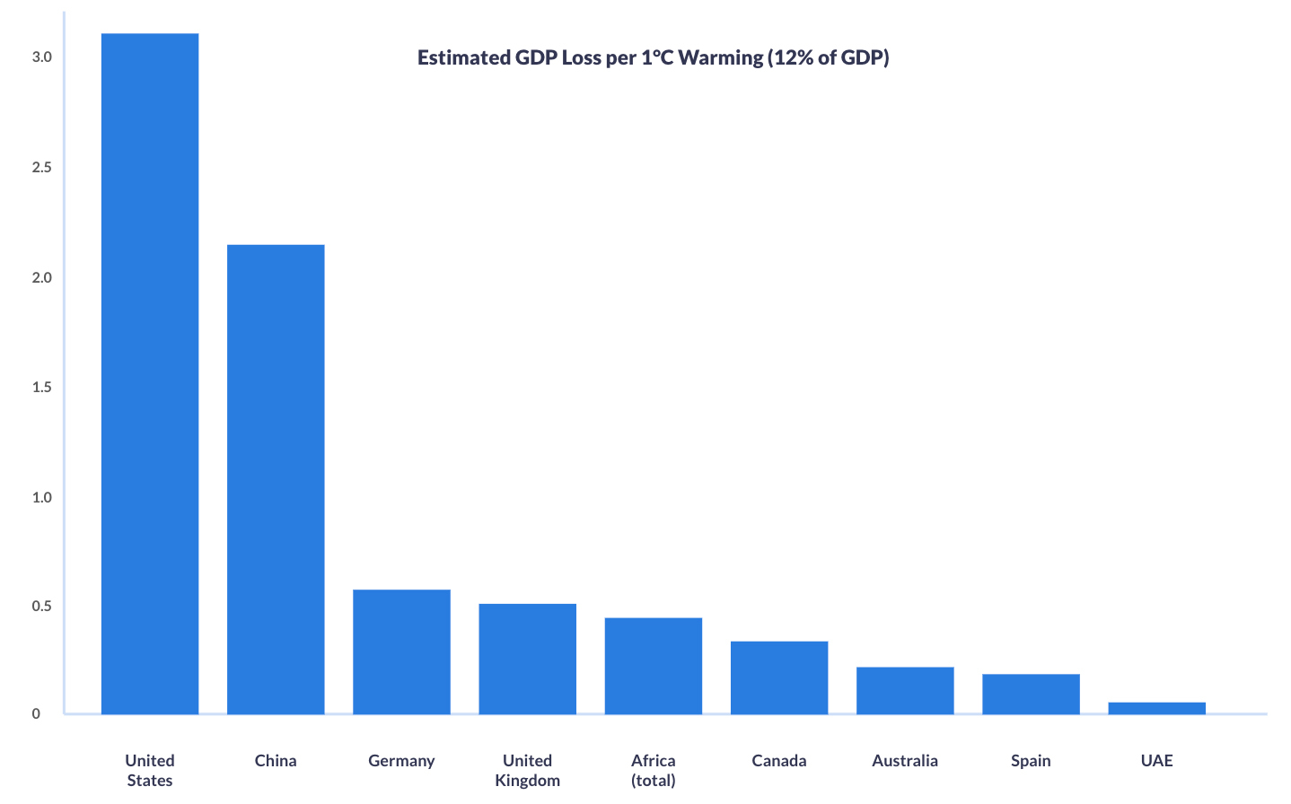
A recent macroeconomic study cited by the World Economic Forum suggests climate warming could cost the world 12% of GDP per °C of temperature rise.
Applied to national economies, this equates to annual losses of over $3.2 trillion for the United States, more than $2.1 trillion for China, and hundreds of billions for other major economies and regions such as Germany, the UK, Africa, and Australia.
These figures underline why investment in environmental monitoring and early warning systems is not just planet saving, but economically essential.
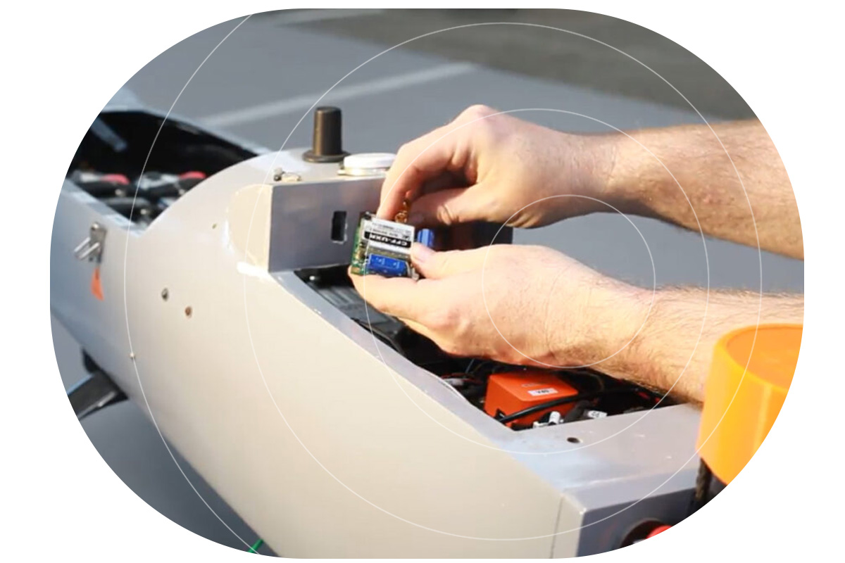
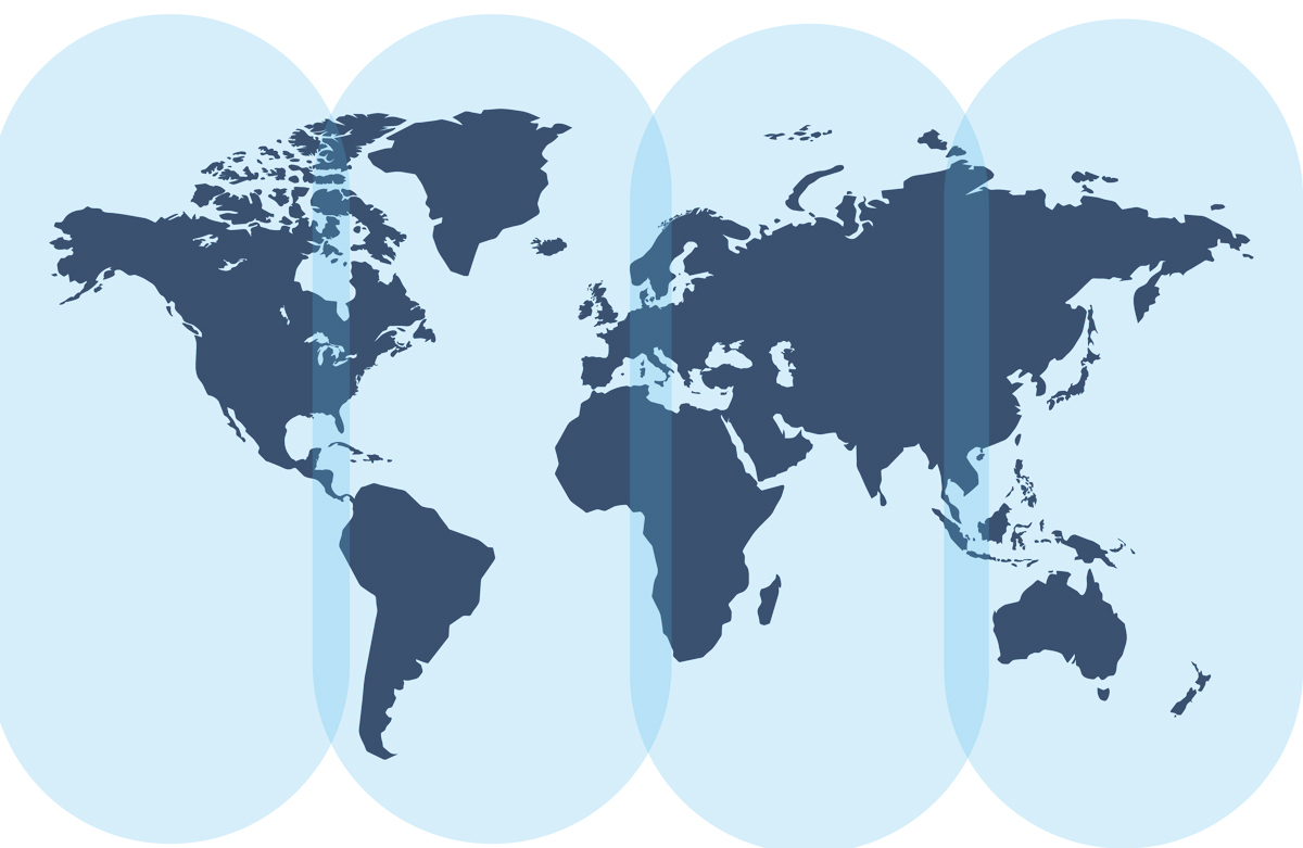
IoT opens new possibilities for environmental insight and protection, but many monitoring sites lie beyond cellular networks, making connectivity difficult.
The Challenge of Monitoring Our Planet
Why is environmental monitoring so hard in remote areas?
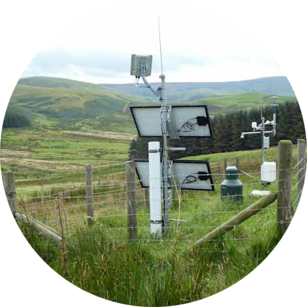
Often, the places we most need data from are the hardest to reach. Accessing remote rainforests, high mountain ranges, vast deserts, polar caps and oceanic regions can be difficult, costly, and dangerous. They don’t have cell towers or power lines, and sending people out to check sensors manually isn’t just impractical, it’s unsustainable. IoT for climate monitoring has opened the door, but the logistics of gathering reliable, continuous data in these places remain challenging.
One essential component of success is collaboration. Environmental monitoring is not something one agency or organization tackles alone. Governments, NGOs, researchers, universities and private tech providers all bring pieces of the puzzle, from scientific insight to provision of physical sensor networks, to the connectivity and platforms that make data flow. When these threads are woven together, they provide a picture accurate and complete enough to act on, but without them, data is disparate, narrow, and potentially unreliable.
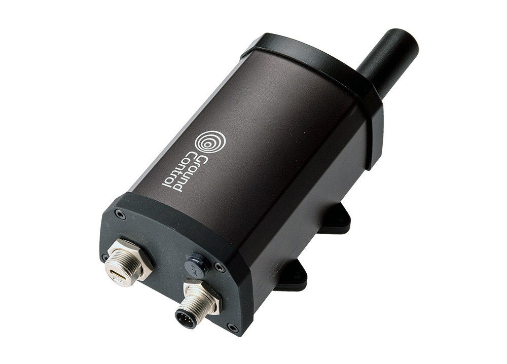
Today, many of these agencies rely on proprietary satellite IoT to monitor the environment and keep people safe.
Environmental Monitoring via Proprietary Satellite IoT
Proprietary satellite IoT refers to connectivity solutions built on closed, vendor specific satellite networks, platforms and hardware. With a history of reliability and low latency, they’re trusted for mission critical applications, and form the backbone of systems that send wildfire alerts from remote forests, trigger flood warnings when rivers surge, or provide SOS capabilities for Rangers far from cellular coverage. These use cases work, and they save lives.
For reference, here’s a quick refresher on a couple of established proprietary satellite services, but feel free to skip ahead if you’re already familiar.
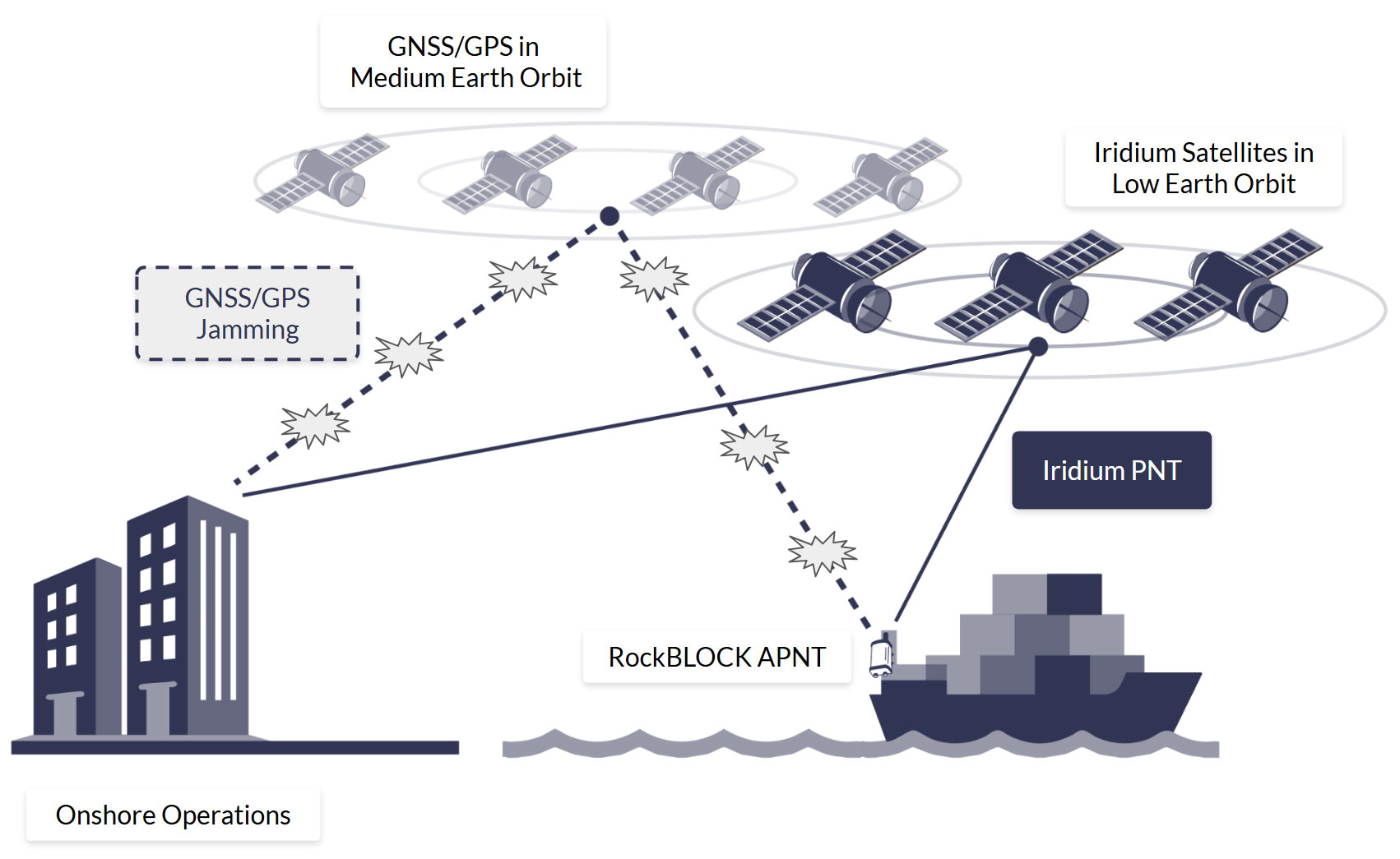
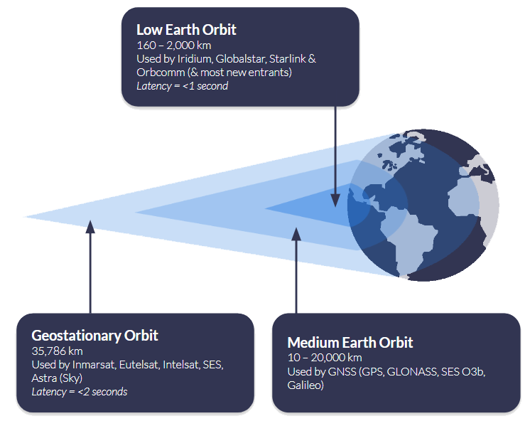
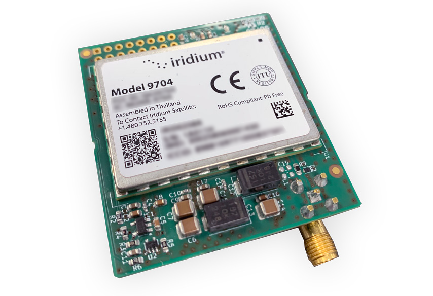
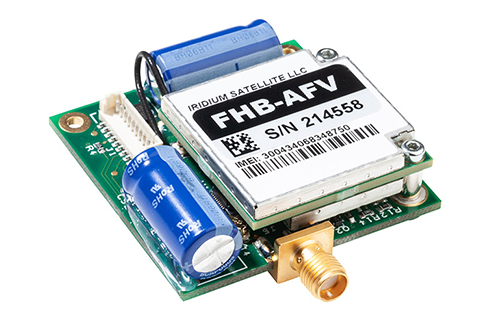
Iridium runs a Low Earth Orbit (LEO) satellite network using L-band spectrum. Coverage is truly global, including the poles, and terminals don’t require antenna pointing. For IoT, Iridium Short Burst Data (SBD) and Iridium Messaging Transport (IMT) handle low-power telemetry and tracking, while Iridium Certus 100 provides lightweight IP backhaul at up to 88 kbps down / 22 kbps up.
Viasat (through its acquisition of Inmarsat) operates primarily in Geostationary Orbit (GEO) at ~35,786 km. GEO satellites appear fixed in the sky, so you get near-global coverage (excluding the polar regions) but you do need to point the antenna and you’ll see higher latency than LEO. Viasat’s proprietary IoT options – IoT Nano and IoT Pro (previously called BGAN M2M) – are chosen for economical, stable, and reliable links where there’s a clear line of sight to the satellite.
Proprietary satellite IoT is trusted because it is proven. Networks like Iridium and Viasat offer global reach, near-real time communication, a broad range of data capacity tariffs, and connectivity that covers the most inaccessible global locations. In situations where seconds or accurate time-stamped data count, that reliability is non-negotiable.
But this approach does come with trade offs. Proprietary satellite IoT devices have added cost, limiting their widespread deployment. Agencies also face vendor lock in due to a lack of interoperability. And the data can end up siloed, with wildfire sensors on one platform, flood gauges on another, and SOS devices elsewhere. The result is a patchwork of insights that are difficult to unify. We’ve previously highlighted the problem of global data disparity and its impacts. The tension between reliability, availability and scalability, proven systems and siloed ones, defines the current status quo.
The Expanding Toolkit: LoRaWAN and NTN
Over the last decade, LoRaWAN broadened the toolkit for low power, local sensor networking, and now 3GPP’s Non-Terrestrial Networks (NTN) are emerging to extend cellular protocols such as NB-IoT and LTE into areas with no terrestrial networks.
Market Incumbents:
LoRaWAN
An open, community-driven protocol maintained by the LoRa Alliance, LoRaWAN gained momentum from ~2015 onward for low power, low cost sensing. It’s ideal for clustered local or regional deployments (e.g., watersheds, forest plots, landslide corridors). Sensors communicate to nearby gateways; those gateways then backhaul data to the cloud, often over satellite in truly remote sites. LoRaWAN is inexpensive, flexible, and easy to deploy, but coverage is only as broad as your gateway network – there’s no inherent global reach.
Proprietary Satellite IoT
Where time- or mission-critical alerts and global reach are non-negotiable, proprietary satellite services remain best in class. They offer deterministic delivery, global footprints (often including the poles), and proven reliability for safety of life or regulatory use cases. The trade off is cost, which can limit the number of sensors you can field at scale.
Market Newcomers:
Standards-Based Satellite (NTN)
3GPP Release 17 (2022) brought Non-Terrestrial Networks (NTN) to life; extensions that take familiar cellular IoT into space. In practical terms, standards like NB-IoT and LTE-M can now connect via satellite using widely available, standards-based chipsets instead of proprietary hardware.
For remote environmental IoT, that shift really matters. A unified ecosystem means terrestrial and satellite links share the same standards, improving roaming, module availability, and making it easier to switch suppliers. Devices can stay simpler too: the same class of modules can reach the network by satellite when there’s no ground coverage, reducing hardware variants across deployments. And as NTN coverage and device support expand, you can scale sensor footprints without redesigning your stack – ideal for basin-scale hydrology, fire risk perimeters, or multi-site geohazard monitoring.
It’s important to be aware that NTN coverage is still limited, so availability will be patchy for some time. Data rates are small (under 50 KB per month) and duty cycles are constrained, so plan for tiny payloads, compression, and aggressive batching. Applications must be latency-tolerant, with buffering, retry, and out-of-order handling. Unlike cellular, antenna positioning and sky view become first-order concerns, and power budgets are tighter due to longer air-time and higher TX demands.
In this expanding marketplace, there is no single winner in terms of connectivity choices. The toolkit is widening, broadening opportunities and use cases.
Within the current climate (pun intended), with high demand and fast evolving tech, the expertise lies in matching the right connectivity to the right environmental challenge, and future proofing the technologies selected.

Use Cases: Matching Tech to Need
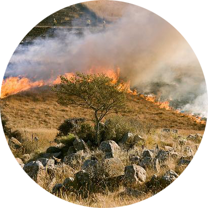
Wildfire Detection
Flood Monitoring
Biodiversity Tracking
Soil and Water Quality Monitoring
Marine Pollution Tracking

Glacial and Permafrost Monitoring
Exploring the Deployment Realities
Let’s talk coverage: How “global” are these options?
- Proprietary Satellite IoT
Iridium: Truly global, pole to pole, provided the device has a clear view of the sky. No antenna pointing required.
Viasat (Inmarsat L-band): Near-global footprint excluding the extreme polar regions; requires antenna pointing for a stable link. Best when you want economical, stable links, and have a clear line of sight to the satellite. - LoRaWAN
Coverage is inherently regional: each node talks to a nearby gateway. In open areas, practical node-to-gateway distances are roughly up to ~15–16 km (terrain and clutter can reduce this). If your monitored area is wider than that, you either give each endpoint its own satellite connection, or build a local LoRaWAN network and backhaul one or more satellite-connected gateways. - NTN (e.g. NTN NB-IoT, NTN LTE Cat-1, NTN LTE-M)
Coverage is early and patchy. Commercial availability today is concentrated in specific countries/regions with little to no ocean coverage (view current NTN coverage map from Viasat). Viasat has the most coverage, but is restricting services to areas where there is sufficient demand; thus, as more hardware / devices reach the market, and the use cases become clearer, we would anticipate coverage growing.
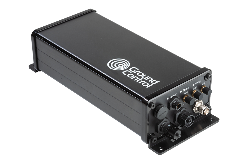
Reducing Silos With a Unified Data Plane
Successful deployments depend on how easily devices, platforms, and networks exchange data. The practical goal is a single pane of glass where you can see, manage, and act on data from mixed networks – proprietary satellite, NTN (as it rolls out), and, where available, cellular- without rewriting everything each time you add a site or change a bearer.
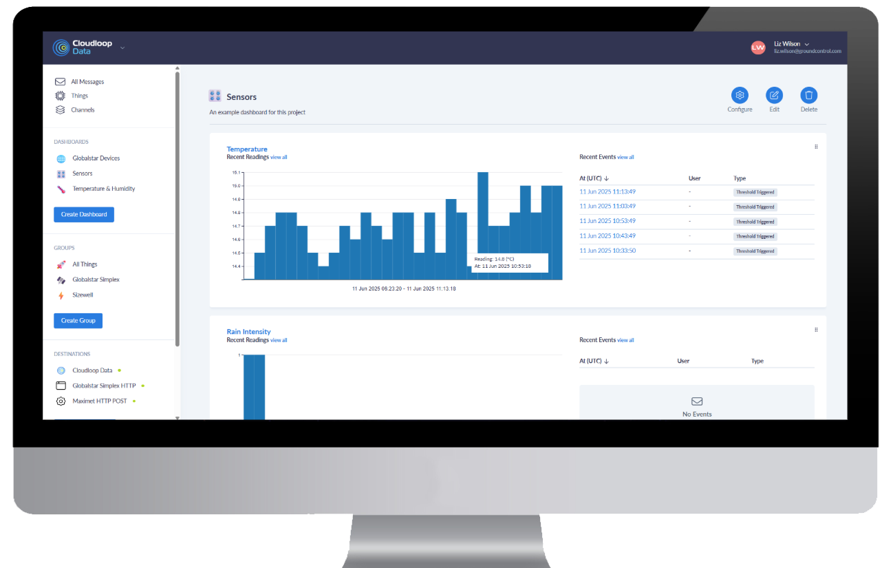
A pragmatic way to get there is an API-first platform that’s device- and network-agnostic. For example, Cloudloop is designed to ingest data from heterogeneous bearers and present it through one interface. It doesn’t make coverage universal, but it can reduce integration work and lower the risk of data silos as footprints grow.
Security: Keeping Environmental Data Trustworthy
Environmental monitoring data increasingly informs safety, regulation, and policy, so protecting its integrity matters as much as collecting it. For remote environmental monitoring, satellite IoT reduces exposure to common internet borne threats because links don’t rely on local terrestrial infrastructure or public ISPs. In practice, that means fewer attack surfaces between field sensors and your platform.
Advantages and limitations of satellite IoT security:
High Encryption Standards by Default
Professionally operated, mature satellite networks such as those operated by Iridium and Viasat encrypt data using AES-256, a symmetric block cipher algorithm recognized for its security and efficiency.
Avoids Man-in-the-Middle Attacks
Satellite networks are much harder to compromise via MitM attacks due to their direct transmission methods, reduced ISP reliance, high-altitude signal paths, and strong encryption. However, they’re not completely immune. The means by which data is routed from the ground station to the user’s application needs consideration.
There are several options here with varying degrees of security:
- VPNs / Firewalls – The most commonly deployed method for securing data being moved from a ground station is to utilize a combination of firewalls and VPNs.
- Private Wire – Private wire connections create a direct, secure link between a satellite ground station and a customer’s network, bypassing the public internet entirely. This can be achieved through dedicated leased lines or private Layer 2 circuits (such as MPLS or SD-WAN). This results in a closed, high-security data path that prevents exposure to cyber threats like DDoS attacks or data interception.
The bottom line: Satellite won’t eliminate risk, but its independence from local infrastructure, combined with private routing, encryption, segmentation, and failover, gives environmental programs a materially stronger default security posture than relying on terrestrial connectivity alone.
From Insight to Action: Key Considerations for Choosing the Right Connectivity
Understanding these findings is just the start. The next step is applying them, choosing the right technology mix to meet real world monitoring goals while staying compliant, scalable, and resilient.
|
Project Pain Points |
Ways to Resolve |
||

“We can only afford a handful of sensors, but we need scale.” |
Utilize NB-IoT/NTN NB-IoT for assured security or LoRaWAN sensor networks with satellite backhaul for affordable, dense deployments. |
||
|
“We need reliable alerts for emergencies.” |
Use a proven, proprietary L-band satellite IoT link e.g., Iridium SBD/IMT or Certus 100, or Viasat IoT Nano/Pro that’s stress-tested for mission critical use. |
||
|
“Coverage is patchy, how do we know what will actually work in our region?” |
Iridium’s proprietary services are global, LoRaWAN is regional, and NTN NB-IoT is emerging. Check coverage maps for more detailed information, or speak to a remote connectivity professional. |
||
|
“Our systems don’t talk to each other.” |
Utilize Cloudloop functionality with APIs for interoperability. Consume your data in a way that is right for the collaboration, including sending data securely to multiple (pre-integrated) destinations. |
||
|
“We’re worried about data security and compliance.” |
Choose partners that prioritize end-to-end encryption, secure APIs, and compliant cloud hosting. Ground Control’s Cloudloop platform ensures data integrity across hybrid networks while maintaining full customer control over data destinations. |
||
|
“We can’t do this alone.” |
With proven expertise Ground Control is a valued technical partner, not just a provider. Helping NGOs, agencies, and companies to deploy hybrid, collaborative solutions. |
Building a Smarter, More Connected Planet
The future of environmental monitoring isn’t about replacing one connectivity technology with another; it’s about building hybrid IoT networks that combine the best of each. Proprietary satellite IoT will continue to deliver life- and mission-critical reliability, providing resilient links and accurate, time stamped data from even the most remote regions. Meanwhile, standards-based NB-IoT and LoRaWAN are unlocking scalable, low-cost sensor deployments bringing environmental data collection to new levels of density and insight.
When agencies, NGOs, and research partners collaborate across these ecosystems, we can turn isolated measurements into continuous, planetary-scale intelligence.

Looking to Find Your Connectivity Partner ?
At Ground Control, we bridge today’s proven systems with tomorrow’s scalable standards, helping organizations deploy what works now while preparing for what’s next. If you’re exploring how to expand your monitoring capability, talk to our team about designing a solution that fits your goals, your environment, and your stakeholder needs.
Email hello@groundcontrol.com or complete the form, and we’ll be in touch within one working day.