With the growing need to secure new data from remote and inhospitable areas of scientific interest balanced against commercial challenges and tough competition for academic budgets as a background, Ground Control reported an upsurge in its Iridium satellite communication products being used for environmental science applications in both the Arctic and Antarctic.

Several successful deployments have proven the robustness of the company’s RockBLOCK and RockFLEET systems, highlighting their suitability for reducing costs not only in the research sector, but also in commercial industries such as oil & gas and mining.

Ground Control is the manufacturer of the innovative RockBLOCK, a tiny device that can be integrated with most computing platforms to provide global data transmission capabilities even at the Poles. The system is currently being used by a team from the National Institute of Water and Atmospheric Research – New Zealand (NIWA) to measure the effects of storm waves on sea ice. RockBLOCK has been integrated on specially developed wave buoys deployed on to sea ice floes in the Arctic and Antarctic by NIWA. The system transmits GPS position and signal strength data from the buoys every hour, allowing the teams to plot the movement of the ice against wave data.
 

Project contributor Scott Penrose, software architect at Digital Dimensions, said: “The research is vital as it supports investigation into current environmental changes at the Poles while informing the development of future models. RockBLOCK helps us collect data from our wave buoys using Iridium short burst data, which is the easiest and most cost-effective way, especially considering the low cost of the device itself. Despite this, the system is more than capable of operating in such extreme environments while providing reliable data according to our set schedule.”

 
Ground Control’s Iridium technology is also being used in the Arctic by the Laboratory for Cryospheric Research, which is dedicated to the monitoring and understanding of the frozen earth including glaciers, ice caps, ice shelves, snow, and sea ice.

Laboratory members are undertaking research across northern Canada, including monitoring glacier changes in Kluane National Park, examining ice shelf and sea ice interactions along northern Ellesmere Island, and measuring glacier and ice cap dynamics across the Canadian Arctic Archipelago. A team from the laboratory is using Ground Control’s RockFLEET product, combined with a solar panel and extra battery pack, to provide long term position monitoring of sea ice in the region.
 

Nick Farrell, director of Rock Seven (now trading as Ground Control), said: “Operating in such extreme environments can be costly, so research teams are looking at ways to reduce their spend. RockBLOCK and RockFLEET fulfil this need, whilst still providing the reliability of much more expensive systems, in terms of hardware and airtime costs. There’s real potential for technology transfer from research to commercial industries based on these developments. We’re seeing more interest from the oil and gas industry for instance, where data originating at facilities in remote or hazardous locations can inform if an engineer needs to visit or not.”

 
Designed to work with any platform with a serial or USB port, including Arduino™, Raspberry PI™, and Intel Edison, as well as Windows, Mac, and Linux computers, RockBLOCK is a simple and reliable way to integrate two-way communication into sensor and measurement based research projects. It can send messages of 340 bytes and receive messages of 270 bytes using Iridium short burst data, which offers global, pole-to-pole coverage. At just 76.0 x 51.5 x 19.0mm, the system can be integrated easily into almost any sensor station. The RockFLEET system offers the same communication capabilities as RockBLOCK but comes in a sealed form factor for permanent installation.

Get in touch

We've implemented satellite IoT infrastructure for decades, and there's very rarely been an obstruction issue we couldn't overcome with a bit of knowledge and ingenuity.

We'd be happy to talk to you about your project and offer impartial advice on the best antenna and satellite service for your particular requirements. Call or email us, or complete the form.

The Laboratory for Cryospheric Research is dedicated to the monitoring and understanding of the frozen earth, including glaciers, ice caps, ice shelves, snow, and sea ice. The facility was opened in September 2007, with funding from the Canada Foundation for Innovation, Ontario Research Fund, and University of Ottawa.

Laboratory members are undertaking research across northern Canada, including monitoring glacier changes in Kluane National Park, examining ice shelf and sea ice interactions along northern Ellesmere Island, and measuring glacier and ice cap dynamics across the Canadian Arctic Archipelago. The Laboratory for Cryospheric Research is based in the Department of Geography at the University of Ottawa, and directed by Dr. Luke Copland.

Dr Copland is using our RockSTAR product, combined with a solar panel and extra battery pack, to provide long-term position monitoring of the sea ice. He’s sent some wonderful pictures back showing the setup, and it’s amazing to see just how large these floating blocks of ice are.

You can find out more about the project here: https://cryospheric.org/.

Get in touch

We take pride in designing and building the RockSTAR ourselves. Over the years we've enhanced and added features based on feedback and specific customer requests, to ensure our device meets your needs.

Simply complete the form to find out whether the RockSTAR is the right fit for your organization. With our 20 years of expertise, we'll guide you in making the optimal choices for your critical communication requirements. If you prefer to speak to someone directly, call us on +44 (0) 1452 751940 (Europe, Asia, Africa) or +1.805.783.4600 (North and South America).

Instant Detect is a State-of-the-Art Conservation System

Instant Detect is a conservation system designed to remotely monitor wildlife population and movements, and to play a leading role in anti-poaching efforts. The Zoological Society of London (ZSL) developed Instant Detect with funding from Google’s Global Impact Award, which it won in 2013.

UK-Based Remote Monitoring

With the monitoring HQ in London, the Instant Detect cyber safety net is a truly global application of technology. The system has been used in Antarctica to monitor penguin populations and in Kenya in collaboration with the Kenyan Wildlife Service to tackle elephant and rhino poaching. The Tsavo region of Kenya alone has seen more than 1,000 rhinos killed in the last 18 months.

Traditional wildlife monitoring systems rely on SD cards or mobile cellular networks to save or upload images and data. These systems suffer due to lack of real-time imagery or simply don’t work when mobile coverage is lacking.

Joint Collaboration

Instant Detect was developed in collaboration with Cambridge consultants Iridium, Seven Technologies Group, and Wireless Innovation Ltd (now trading as Ground Control) in response to these issues. The covert system now sends data instantly via satellite to the ZSL team. When human activities trigger the system sensors – particularly with the presence of metal – the team alerts rangers to the presence of poachers with photographic proof. This early warning allows local enforcement to react quickly and keep a virtual eye on remote regions.

Get in touch

Whether you have your own Environmental monitoring and reporting software, or are an OEM responsible for manufacturing meteorological sensors, if you want to explore integration options with Ground Control's satellite connectivity devices, we'd love to hear from you. Simply complete the form and one of our experienced team will contact you.

We’re pleased to announce that SparkFun are now an official distributor of the RockBLOCK 9603 and RockBLOCK 9602 units in the USA.

The RockBLOCK 9603 allows you to send and receive short messages from anywhere on Earth, so long as you have a clear view of the sky. It works far beyond the reach of Wi-Fi and GSM networks. It’s perfect for the electronics hobbyist or maker who wants to transmit weather information from mid-ocean or use it to control their robot in the middle of the desert.

SparkFun is an online retail store that sells the bits and pieces to make your electronics projects possible. No matter what your vision is, their products and resources are designed to make the world of electronics more accessible to the average person.

In addition to products, SparkFun, through their Department of Education, offers classes and online tutorials designed to help educate individuals in the wonderful world of embedded electronics. Their ever-growing product catalog boasts over 3,500 components and widgets designed to help you unleash your inner inventor.

See the RockBLOCK 9603 and RockBLOCK 9602 on the Sparkfun website.

Already established as an innovative, low-cost satcom system for commercial M2M applications and internet of things (IoT) developers, Rock Seven (now trading as Ground Control)’s RockBLOCK plug and play two-way global communications system has been upgraded to offer more flexibility for commercial users. In addition to more standardised interfacing, RockBLOCK Mk2 now offers the choice of using an on board or external Iridium antenna.

Designed to work with any platform with a serial or USB port, including Arduino, Raspberry PI,  Intel Edison, as well as Windows, Mac, and Linux computers, RockBLOCK is a simple and reliable way to integrate two-way communication into any sensor or automation focused product design. It can send messages of 340 bytes and receive messages of 270 bytes using Iridium short burst data (SBD), which offers global, pole-to-pole coverage.

New features in RockBLOCK Mk2 include the addition of an optional SMA connector, so external antennas can be used instead of the onboard patch antenna. Rock Seven has also changed its equipment interface approach, replacing the original RockBLOCK’s proprietary break-out connector with a standard 0.1″ pitch connector. Both developments are aimed at giving greater flexibility when developing communication capabilities at the design stage of a project, whilst enabling simpler installation and interfacing.

As an easy-to-implement and operate system suitable for all levels of technical expertise, RockBLOCK provides a diverse user-base with a reliable way to communicate with and control equipment remotely. RockBLOCK Mk2 is designed to support commercial organisations in their effort to extend the IoT to remote areas, from the deserts and poles to oilfields, wind farms, and near-space.

Launched alongside the ‘Naked’ RockBLOCK Mk2 is a new version delivered in a robust case, called RockBLOCK Plus. Designed for rugged applications, RockBLOCK Plus is encapsulated in a waterproof IP68 housing and includes a 3m lead. It takes 9-30v DC power (instead of 5v on the standard RockBLOCK Mk2) and RS-232 signals (instead of UART).

RockBLOCK+ is ideally suited for use by commercial organisations operating in hazardous or inclement environments and is especially relevant for maritime application on workboats or ‘smart buoys’.

RockBLOCK Mk2 is a low-cost way to integrate remote machine-to-machine (M2M) communication functionality into any project. The product and service is available globally from Rock Seven or via international re-sellers.

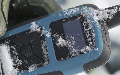
Our RockSTAR and RockFLEET devices are used throughout the world, tracking all sorts of things – people, vehicles, machines, animals. Most of the time you set a transmission frequency for the unit (e.g. once every 15 minutes), attach the tracker, and then leave it to do its job.

However, over the years we’ve been asked whether this speed could vary, depending on the motion of whatever the tracker was attached to.

So we’ve come up with ActivitySense.

ActivitySense has been introduced in the latest version of firmware for RockSTAR and RockFLEET units. It uses a combination of sensors to determine whether something is moving. The problem is, different things move in different ways – so how do we cope with that? Let’s take a look.

ActivitySense on Cars and Bikes

When a car’s engine is running and driving along the road, there tends to be an element of vibration. When the car or bike stops and the engine is turned off, that vibration goes away. To detect this, we use a mode called ‘Bump’, which employs the accelerometer inside the tracker. If we detect vibration continually for a period of 10 seconds, we start transmitting at a faster rate. When that vibration has stopped for 60 seconds or more, then we drop the unit back down to its normal transmission rate.

Obviously different vehicles have different levels of vibration, so we have an adjustable threshold, meaning you can tune the detection to match your particular requirements.

ActivitySense on Airplanes

While an airplane will tend to vibrate and bump around when on the ground, once it reaches cruising altitude and throttles back, most of that vibration goes away. So we can’t use the same vibration-detection method we use on cars and bikes.

Instead we use the GPS chip and have a mode called ‘Bump+GPS’ – the vibration on the ground initially wakes the unit up and turns on the GPS chip. The transmission speed increases. We then monitor the speed of the plane via the GPS chip, and we keep transmitting more quickly until the GPS speed drops below 4mph, as the plane is hardly likely to be in the air at that speed. Then we drop the transmission rate down again and wait for bumps to wake it up next time.

ActivitySense via Power

For some applications, we’ve been asked if our units can transmit more quickly when receiving external power – and less quickly when running from batteries. Again, we have a mode in ActivitySense to detect this, simply called ‘Power’. If external power is applied then the tracking frequency can be faster than if running on battery.

A good example of this is one of our customers, who uses units on rapid deployment rigid inflatable boats. Whilst the boats are ‘docked’ on the mother-ship, they transmit once every two hours. As soon as the ignition is switched on, they start taking positions every five seconds, transmitting once a minute.

Cost Savings

Apart from the flexibility ActivitySense gives our customers, by automatically managing how often it transmits at different times, it also saves them money. Each position report transmitted over the Iridium satellite network costs money, so why transmit every five minutes for days on end when whatever you’re tracking is sat in the same place?

To find out more about ActivitySense, or any of the other features of our products, get in touch.

Get in touch

We've implemented satellite IoT infrastructure for decades, and there's very rarely been an obstruction issue we couldn't overcome with a bit of knowledge and ingenuity.

We'd be happy to talk to you about your project and offer impartial advice on the best antenna and satellite service for your particular requirements. Call or email us, or complete the form.

Finding a suitable location is one of the biggest challenges in the renewable energy industry. For a solar installation to be successful, it has to deliver a consistent and reliable supply of energy. To do this, it must be situated in exactly the right place. To justify the investment that a solar thermal power plant requires, developers need detailed knowledge of the environment as well as data on the performance of installation equipment.

Since these sites are often in remote and inaccessible desert locations, data gathering stations have to be designed to withstand harsh conditions – they need to be robust, efficient, and low-maintenance. It’s impractical and hazardous to retrieve data manually so measurement stations also need to provide reliable and secure remote connectivity, ensuring data can be collected and equipment monitored.

To provide the reliable data backhaul required for a recent solar energy assessment project developer, organisations need a robust satellite, such as the RockREMOTE solution from Ground Control.

The RockREMOTE is an Iridium-based solution that provides secure, reliable satellite connectivity in places where GPRS coverage is poor. It’s a flexible and programmable solution that removes any reliance on the existing terrestrial infrastructure. RockREMOTE allows data logging solutions to be deployed in remote and hostile locations, seamlessly integrating with data loggers to provide secure, reliable connectivity over the Iridium satellite network.

Ground Control’s extensive experience in renewable energy and detailed technical understanding of the entire infrastructure ensures customers receive a complete end-to-end solution. So, instead of agonising about the challenges of installing a renewable energy resource, why not take advantage of our ‘solutions without strings’ approach?

Please enable JavaScript in your browser to complete this form.
Name
Privacy Policy

‘Big data’ has become part of the Maritime lexicon in recent years. It’s hailed as the answer to achieving operational efficiencies, and is part of the reason that the demand for bandwidth at sea continues to grow.

The use of big data somewhat reflects how internet usage patterns at sea follow that of businesses on land. As satellite capacity grows, service providers, IT companies, and equipment manufacturer work out ways to use it to gain efficiencies and ultimately save costs for ship owners and operators. Many of these applications are based on the concept of machine-to-machine communication, also known as M2M. Sensors in onboard equipment can talk directly with applications on land via satcom – delivering automated reports and statistics, for instance, which can be leveraged to understand vessel performance better.

Though M2M applications can run over the VSAT equipment found on ships, the use of M2M communication isn’t limited to large commercial vessels. New systems have been developed that focus on understanding the challenges of communicating at sea for smaller vessels, especially in terms of cost, security, and the lack of space onboard, which may rule out the installation of a large satcom antenna. So with smaller, lower-cost equipment and lower-bandwidth services, the world of M2M is opening up for vessels of all types and size. ‘Small data’, if you like.

Ground Control is at the forefront of this scaling-down of satcoms for M2M applications, with its RockFLEET and RockBLOCK products.

RockFLEET

The RockFLEET Tracker is a truly global tracking device designed for permanent use aboard marine vessels and land vehicles. Its optional LTE Narrowband unit allows it to use mobile phone networks when possible, automatically switching to the global Iridium satellite network when necessary (lowest-cost routing).

RockBLOCK

RockBLOCK 9603 is a plug-and-play two-way global communications system designed to work with any computing platform with a serial or USB port, including Arduino™, Raspberry PI™, Intel Edison, Windows, Mac, and Linux computers. It’s a simple, low-cost, and reliable way to integrate two-way communications into any M2M system. It can send messages of 340 bytes and receive messages of 270 bytes using Iridium short burst data (SBD), which offers global, pole-to-pole coverage. It can transmit commands and receive data from almost any equipment on board so the potential applications are huge.

The tiny RockBLOCK 9603 (7.6cm x 5.1cm x 1.9cm) device uses either an onboard patch or external antenna using an optional SMA connector and a standard 0.1″ pitch connector for easy interfacing of equipment. Both of these aspects give greater flexibility in terms of onboard configuration of an M2M network – a vital aspect considering that ship and boat design varies massively.

Also available is the RockBLOCK Plus, designed for rugged applications, encapsulated in a waterproof IP68 housing, and including a 3m lead. It takes 9-30v DC power (instead of 5v on the RockBLOCK 9603) and RS-232 signals (instead of UART). RockBLOCK Plus is ideally suited for commercial organisations operating in hazardous or inclement environments. Essentially, it’s ideal for installing outside on your vessel.

RockBLOCK originally became popular in the so-called ‘makers’ market, where engineers, students, and inventors develop creative projects using IT and electronics components. Everything from oceanology to homemade space planes have used the RockBLOCK system to send and receive commands and the simplicity of the system transfers well to the maritime sector.

As an easy to implement and operate system suitable for all levels of technical expertise, RockBLOCK 9603 provides a diverse user-base with the ability to cost-effectively extend the ‘Internet of Things’ to maritime arena. Thousands of RockBLOCK units have been sold to date. Some notable projects include two-way communication duties on high-altitude balloon launches, a rocket-powered aircraft project, tracking the position of marine buoys for the Poseidon Project, and a marine oil spill response system designed and built by students.

Potential applications on ships and boats include security, automation, and engine monitoring. But unlike the headline, million-dollar complex VSAT networks that are part of the big data and smart shipping concepts, M2M communication using RockBLOCK 9603 is achieved on far more modest budgets. This means privately owned workboats, fishing boats, and yachts can benefit from M2M communication, for basically any application they can think of, while larger fleets can save money and supplement their VSAT systems with an M2M-only solution.

The low initial outlay and airtime costs are also driving maritime technology companies to develop commercial products using RockBLOCK 9603 as a foundation. Although the bandwidth available over Iridium SBD is relatively low compared to VSAT, the potential for developing commercial products that can make a real difference is high.

One innovative application is the use of Ground Control’s M2M communication technology on hyperbaric lifeboats, which are designed to safely transfer divers currently in saturation and unable to decompress for days – should there be cause to abandon their diving ship. Decompression from saturation would cause certain death so modern saturation diving vessels are fitted with at least one hyperbaric lifeboat that can carry up to 18 divers to safety.

When on board the diving vessel, any occupants of the saturation diving chambers will be monitored closely to ensure their health and safety. This poses a challenge should the occupants have to be moved to a hyperbaric lifeboat in an emergency, as the conditions inside the lifeboat chamber have to be maintained to close tolerances of temperature, gas mixture and pressure. The resources available to maintain these conditions within the lifeboat chamber are strictly limited and to maintain the conditions stable for any amount of time is difficult. This makes the monitoring of available resources and conditions within the chamber critical.

A UK-based instrumentation and data logging company for the commercial diving industry is developing a system to make data from hyperbaric lifeboats available over satcom. Though hyperbaric lifeboats have been around for 30 years, this is the first serious attempt to connect them to a monitoring network by satcom. A key challenge until now has been the size and power requirements of satcom antennas. There’s also been a cost consideration, with the majority of satcom services locking users into annual contracts. Considering not a single hyperbaric lifeboat has ever been launched in a real emergency, funding a fleet of lifeboats with an open satcom connection could become costly if using VSAT or other L-band services.

So to enable satcom for data transmission from a hyperbaric lifeboat, the development team has chosen RockFLEET. The system offers the same functionality as RockBLOCK while addressing the size, power, and cost challenges of installation on hyperbaric lifeboats. Operating on the same Iridium SBD service as RockBLOCK, RockFLEET has primarily been designed as an innovative ship tracker. However, Rock Seven (now trading as Ground Control) launched an M2M module in December 2014, opening the RockFLEET system up for a wealth of new applications.

On the cost side, there’s no annual contract, only pay-as-you-go use. The system provides pole-to-pole global position data and each M2M data transmission costs as little as £0.03.

The RockFLEET unit is only 13cm diameter and 4cm high and can easily be integrated with onboard equipment using a variety of serial protocols, whilst RockFLEET’s open API ensures data in any format can easily be delivered to users’ own applications. It’s also the only system of its kind to feature an onboard battery, so if it loses power from the vessel, it can keep on working for approximately two weeks (depending on the application and environment).

These attributes are the drivers behind this project to enhance communication from hyperbaric lifeboats, and should one ever need to be launched for real, the occupants will stand a better chance of being recovered safely when their rescuers have critical data available.

While RockBLOCK provides a singular approach to M2M data, RockFLEET consolidates two key aspects of maritime communication systemsvessel tracking and M2M data. Many shipping companies are keen on the concept of vessel tracking; it’s vital to know where all ships in a fleet are at any one time. But with today’s IT-focused maritime world, it’s now not just possible to receive data from vessels but almost essential to do so in order to operate as efficiently as possible.

With the M2M data module, RockFLEET can provide both position data and any other kind of data required – an advanced feature set, but one that doesn’t cost the earth and can help operations on even the smallest vessel improve through the use of low-cost data communication.

Can we help?

If you are looking for a reliable, secure, and easy-to-use vessel tracking device, then the RockFLEET is a great option. It uses LTE networks where available, and the Iridium satellite network when your device is out of cellular coverage.

Start a chat with our team today and discover how RockFLEET can enhance your marine operations. Complete our online form, or if you prefer to speak to someone directly, call us on +44 (0) 1452 751940 (Europe, Asia, Africa) or +1.805.783.4600 (North and South America). We’re standing by to help.

Please enable JavaScript in your browser to complete this form.
Name
Privacy Policy

A new GSM module developed for the recently launched RockFLEET vessel tracking system introduces least cost routing functionality via terrestrial networks, giving users the opportunity to transmit position data via Iridium globally and switch to terrestrial networks when in range.

With user-definable position reports or short text messages from anywhere in the world costing as little as £0.03 (see SBD Service Plans), RockFLEET is already a highly competitive solution for vessel and fleet tracking and low-cost two-way messaging at sea. Launched in September 2014, Rock Seven (now trading as Ground Control)’s latest Iridium-based satellite tracking system now offers even greater cost control with the ability to send position reports to the shore office using GSM data when in range.

RockFLEET GSM functionality is a factory-fitted option that doesn’t change the size or compact form of the RockFLEET unit. It has no additional antenna for GSM use and can be supplied with a global roaming GSM SIM – or users can choose to install their own SIM from their preferred provider.

In addition to enabling least-cost routing of data (GSM when inshore and Iridium when offshore), users can take advantage of the increased throughput at a lower cost on GSM to send more data more often. This is especially relevant for the efficiency of coastal and inland vessels, considering the recent introduction of an M2M (machine-to-machine) data module for RockFLEET and its potential telemetry and automation applications.
 

“We continue to develop new capabilities for RockFLEET based on customer requests and market trends,” says Nick Farrell, director at Rock Seven t/a Ground Control. “The GSM module can reduce operational costs by switching to cheaper mobile networks, but it also gives access to more bandwidth than available offshore, so it can facilitate increased usage of RockFLEET position data transmission, two-way messaging, or M2M applications without increasing costs.”

 
Though focused on operational costs, RockFLEET is a sophisticated, rugged tracking device designed for maritime and land vehicle use. With no annual contract and pay-as-you-go use, RockFLEET is designed to simplify and reduce the cost of single vessel and entire fleet tracking, supporting ship and vehicle owners to increase safety and efficiency through improved fleet management. It provides pole-to-pole global position data using the Iridium short burst data (SBD) capability.

RockFLEET is the only GPS vessel-tracking device with an internal battery back-up, so it can continue to transmit position for up to two weeks if external power is cut. With facility to mount RockFLEET covertly, this makes it especially suitable for vessels traversing piracy hotspots.

Get in touch

If you are looking for a reliable, secure, and easy-to-use vessel tracking device, then the RockFLEET is a great option. It uses LTE networks where available, and the Iridium satellite network when your device is out of cellular coverage. Perfect for a variety of maritime applications and backed by a team of experts who are dedicated to providing you with the best possible support.

Start a chat with our team today and discover how RockFLEET can enhance your marine operations. Complete our online form, or if you prefer to speak to someone directly, call us on +44 (0) 1452 751940 (Europe, Asia, Africa) or +1.805.783.4600 (North and South America). We're standing by to help.