Taking full advantage of IMT, the latest Iridium network service evolution, Ground Control is proud to announce the development of a new Satellite IoT delivery network. This ultra-efficient solution is designed to meet the needs of IoT applications that require transmission of larger data payloads from very remote locations.
What is Iridium Messaging Transport (IMT)?
The new IMT service from Iridium is designed for IoT / M2M applications, and joins several other satellite airtime services in this space. So what makes IMT different?
|
Iridium SBD |
Viasat IoT Nano (IDP) |
IMT |
Iridium Certus 100 |
|
|
Connection Type |
Message Based |
Message Based |
Message Based |
IP Based |
|
Data Volume / Speed |
270/320 bytes per Message |
10 KB per Message |
100 KB per Message |
22 / 88 Kbps |
|
Satellite Orbit |
Low Earth Orbit (LEO) |
Geostationary (GEO) |
LEO |
LEO |
|
Latency |
Very Low |
Low |
Very Low |
Very Low |
|
Cost at 1,000 Bytes Per Month |
$10.50 |
$8.75 |
$17.50 |
$25.00 |
|
Cost at 10 KB Per Month |
$21.00 |
$23.75 |
$21.00 |
$25.20 |
|
Cost at 25 KB Per Month |
$36.80 |
$36.25 |
$21.00 |
$25.50 |
|
Cost at 100 KB Per Month |
$89.30 |
$90.00 |
$30.00 |
$26.90 |
|
Power Usage During Transmit |
0.8 W |
750 mW |
400 mW |
3.5 W |
This table compares these satellite services to each other, not to the broader ecosystem of connectivity options.
Message Based vs IP Based
The simplest distinction between these two means of communication is that message-based services send discrete data packets at intervals determined by the owner / operator; IP-based services can send and receive data continuously. An advantage of IP-based connections is that many, particularly legacy, applications, use TCP/IP protocols, and so data can pass seamlessly between different systems. The major benefit of utilising message-based connections is that they are far lower cost, because you’re only billed for the data payload and not for any communication overhead (e.g. TCP).
Connection Speeds
Iridium already has a message-based airtime service called Short Burst Data, or SBD; Inmarsat has a similar service called IDP (IsatData Pro) – now known as Viasat IoT Nano. Both are designed for very small amounts of data: environmental monitoring and asset tracking for example.
Iridium introduced Certus 100 which offers the ability to send more data, more frequently, and is ideal for legacy installations and telemetry streaming applications.
IMT sits in between these two services; with the ability to send 100 KB per message, far more data can be transmitted than via the SBD or IDP services, but because it’s message-based, it remains a lower cost solution than Certus 100. If you’re sending over 10KB of data per month, it’s also lower cost than SBD or IDP.
Cost
In our assessment, SBD or IDP is lower cost if you’re sending less than 7-10 KB of data per month. IMT via the 9704 module is best if you’re sending up to 55-60 KB of data per month, and IMT via the 9770 module is most economical if you’re sending over 60 KB of data per month.
This is a little over-simplified, and doesn’t take into account commitment, pools, hardware cost, power consumption, physical size, antennas etc., but serves as a guide.
Power Usage
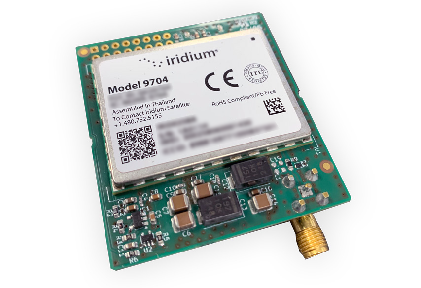
A device leveraging the IMT service will generally use less power than a device using Certus 100, because the data is sent and received on demand, and data packets can be optimized. However, there are two modules that can access IMT, and they have very different power requirements. The 9770 module leverages both Certus 100 and IMT, whereas the new 9704 module only accesses IMT. This has enabled Iridium’s engineers to optimize the 9704 for extremely low power use, better even than IDP and SBD.
Which Devices Utilize IMT?
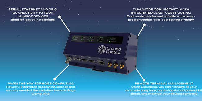
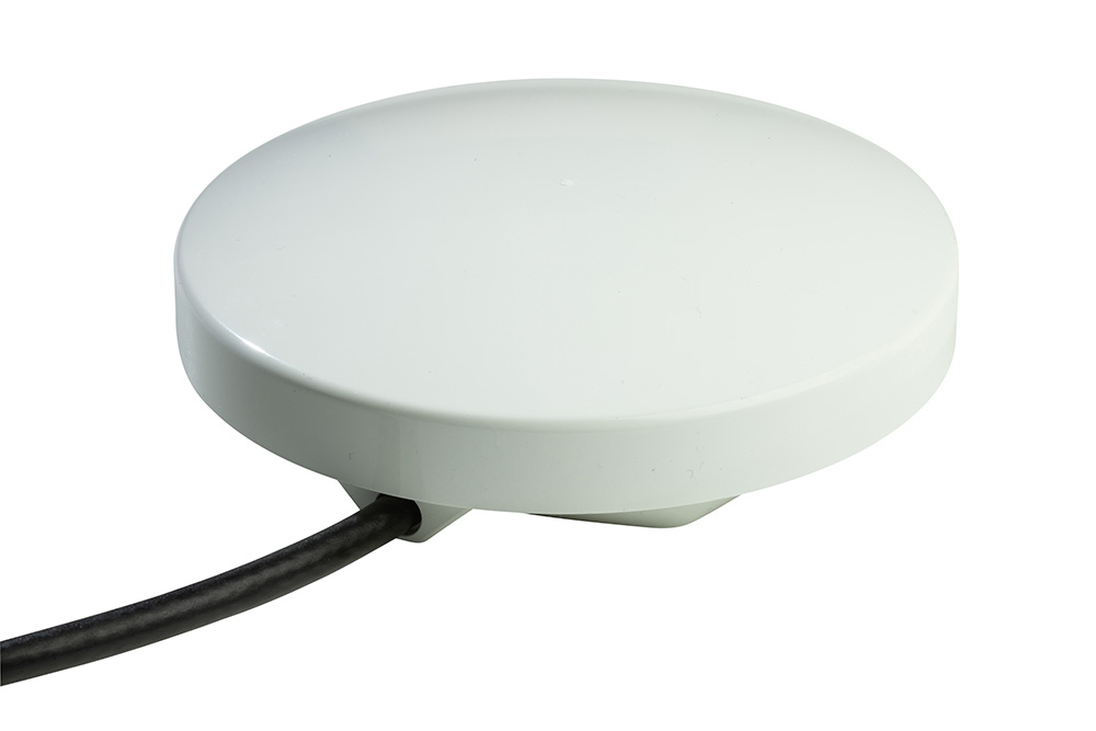
Ground Control’s RockREMOTE devices are based around the 9770 module, making them extremely versatile; they can access IMT and Certus 100 (and in some cases, also cellular). Users configure the device to use the airtime that is most economical for their particular use case; Ground Control will consult and assist with this exercise if needed.
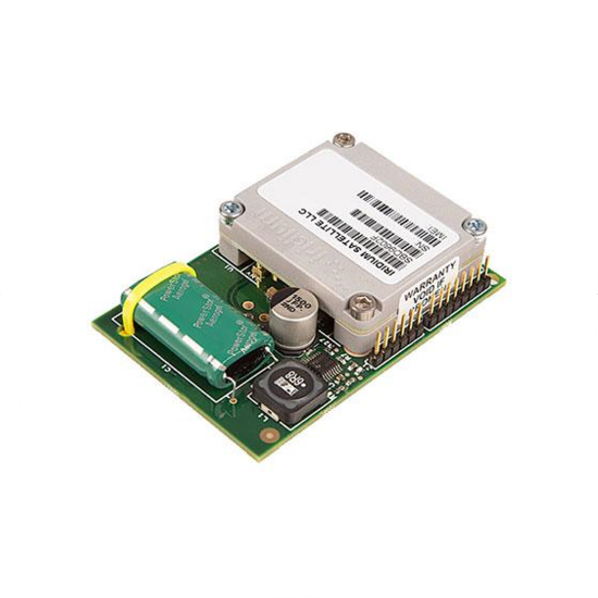
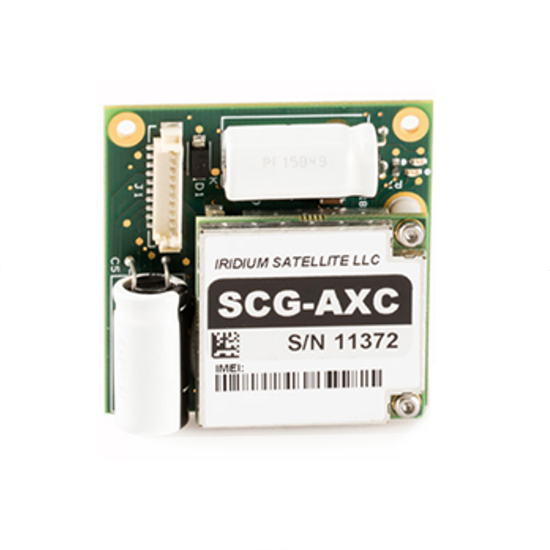
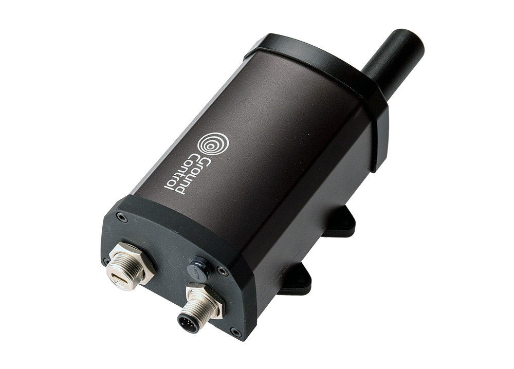
Devices Using the Iridium 9704 Module
The RockBLOCK 9704, RockBLOCK Pro and Pro OEM devices are based around the 9704 module; for data volumes between 10-50 KB per month, they’re extremely cost effective and ideal for very low power applications.
RockBLOCK 9704
RockBLOCK Plus 9704
RockBLOCK Pro
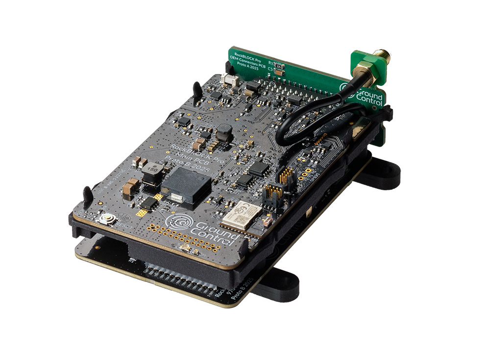
RockBLOCK Pro OEM
When Would You Use IMT?
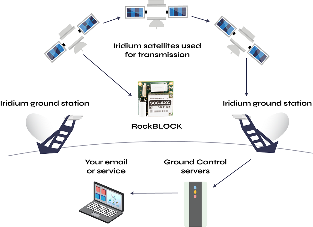
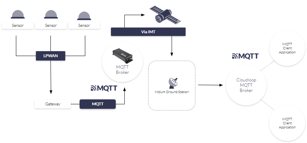
How Does Ground Control’s Satellite IoT Delivery Network Work?
The IoT delivery network is designed to deliver large message payloads for a wide range of IoT applications in a highly cost effective way. It leverages the new IMT satellite service, the RockREMOTE or RockREMOTE Rugged terminals, and the MQTT messaging transport.
It provides an end-to-end solution comprised of:
- An MQTT application deployed on the RockREMOTE or RockREMOTE Rugged terminal; this provides the interface for your remote application to submit and receive data payloads
- The Iridium IMT satellite service
- An MQTT server application, delivered via Ground Control’s Cloudloop platform, which enables your IoT service application to submit and receive data payloads.
A 2021 research paper found that 75% of businesses experienced connectivity challenges when trialing IoT projects, ranging from coverage to interoperability to cost. Ground Control’s IoT Gateway is designed to address each of these challenges, providing global coverage, industry standard interfaces, and cost efficiency.
What is MQTT?
MQTT is a messaging protocol – a structured way for applications to exchange payloads of data between applications – designed for IoT. TCP / IP is another messaging (or communication) protocol, used to connect network devices on the internet, and in private computer networks.
MQTT was designed specifically for IoT, where the data transmission requirements are usually small, and the microcontrollers that host the code are also very small (physically and in terms of the amount of instructions they can support). So MQTT is very lightweight and efficient.
Another advantage of MQTT is that it has small message headers; this is the initial portion of a data packet, and contains control information such as addressing and version. In IP messaging protocols this is (relatively speaking) quite a large amount of information which makes sending data via IP more resource intensive. MQTT’s small message headers ensure that the network bandwidth is optimised.
It has become the industry standard for newer IoT projects because of its many advantages, including reliable message delivery, security, and scalability.
For more information on MQTT, visit https://mqtt.org/.

Talk to us about IMT
If you have an IoT connectivity challenge which satellite can solve, and you’d like expert, impartial advice on the best airtime and delivery network for your requirements, email or call us, or complete the form.
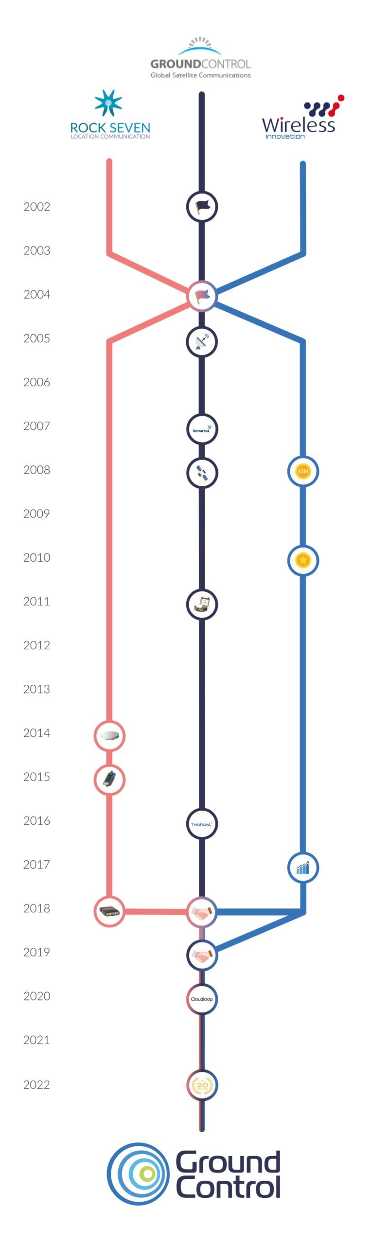
We’ve been delivering satellite and cellular connectivity services for over 20 years, and our partnerships with leading satellite operators means we can offer great pricing and a robust, reliable service, in addition to our commitment to delivering innovative, customer-driven data and device management solutions.