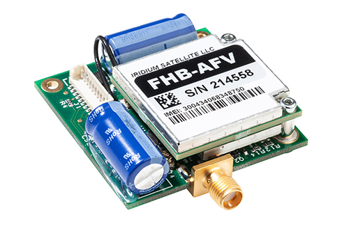
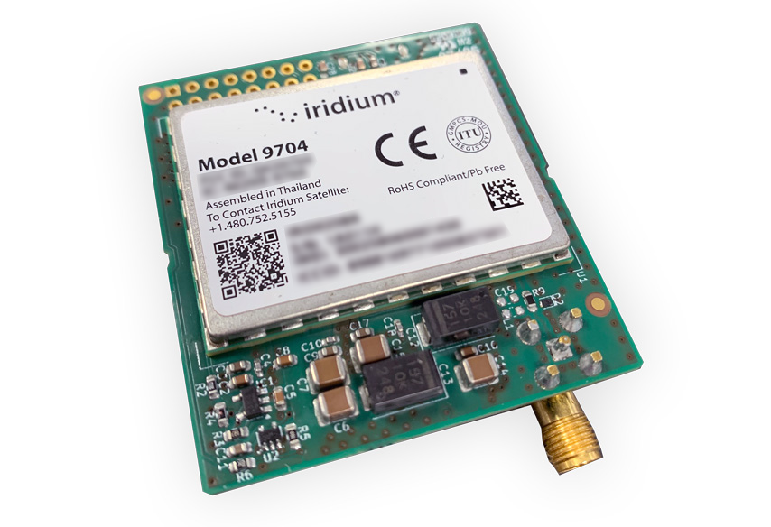
Iridium have just launched their latest satellite transceiver, the Iridium Certus 9704. In this post we’re going to explore how this module compares with other satellite IoT modems, the Iridium 9603 and Certus 9770. We’ll look at ideal use cases for the new transceiver, how to get the best out of the device, and how to get started.

What is the Iridium Certus 9704?

The 9704 is a small, lightweight and low power satellite IoT transceiver that connects to the globally available Iridium satellite constellation.

It leverages Iridium Messaging Transport (IMT), a message-based service which allows users to transmit data packets of up to 100 kB. What is IMT?

Iridium-Certus-9704

What Applications are Suited to the 9704?

The 9704 has been designed to consume very little power, so it’s ideal for remote, battery-powered applications. For example, telemetry from heavy machinery; SCADA readings from unmanned substations or infrastructure; aggregated gateway / hub data; data logger transmissions.

It can also be used for simple UxV commands; stop, start, return etc.

How Does the 9704 Differ from the 9603 Transceiver?

The 9603N is very similar in form factor to the 9704: 31.5 x 29.6 x 8.1 mm vs. 31.5 x 42 x 4.5 mm, and 11.4 g vs. 12 g respectively*.

Both draw similarly small amounts of power, and both utilize message-based services. But the message size for the 9603 is considerably smaller compared to the 9704; 340 / 270 bytes (Short Burst Data) vs. 100 kB (Iridium Messaging Transport). The speed at which the data is transmitted is also doubled with the 9704; from 2.4 Kbps to 4.8 Kbps.

Applications best suited to the 9603 include asset tracking, environmental monitoring and fleet management; it remains the most cost-effective way to move smaller volumes of data using the Iridium satellite constellation.

View 9603-Based Products
9603 size vs 9704 size
9770-OEM-Mini-3

How Does the 9704 Differ From the 9770 Transceiver?

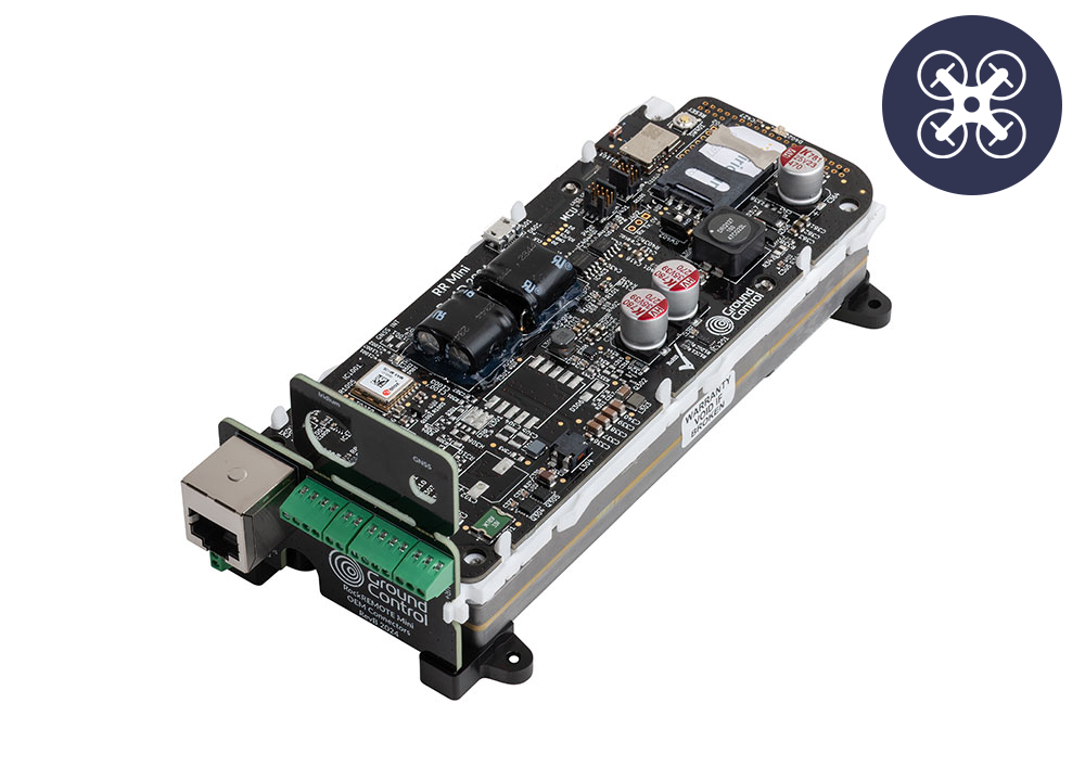
The Iridium Certus 9770 modem is a more powerful device. It can send data over IMT, but also over IP, creating greater flexibility and making it more suitable for applications where real-time command and control is required – for example, piloting a drone BVLOS.

The 9770 sends data far more quickly; 22 / 88 Kbps vs the 9704’s 4.8 Kbps (Tx/Rx). But this comes with a greater power draw; the 9770 requires 3.5 W to transmit/receive, whereas the 9704 requires just 400 mW*.

The 9770 is also larger and heavier than the 9704; 140 x 60 x 16 mm and 185 g vs. 31.5 x 42 x 4.5 mm and 12 g respectively*.

The Certus 9770 can be used for voice communication, and the 9704 is data only.

Devices utilizing the 9770 transceiver are ideal for remote control of assets such as UAVs and USVs; or when it’s important that data is moved quickly, so any form of alerting mechanism such as remote security or systems failure alarms. They will also be the preferred choice of systems integrators who want the flexibility to switch between IP and message-based transmissions depending on the type of data being moved.

View 9770-Based Products

Which Devices Utilize the 9704 Transceiver?

At the time of writing, you can purchase a developer kit and build the 9704 transceiver into your enclosure. We are IMT and Iridium experts, having worked with the Iridium development team for decades, and we are here to help you get the best out of Iridium Messaging Transport.

We are prototyping two new devices to leverage the new technology; the RockREMOTE Nano, for IoT applications, and the as-yet-unchristened successor to the RockFLEET, which is our multi-purpose, all-weather tracking and IoT device.

Iridium-9704-Developer-Kit

What is Iridium Messaging Transport (IMT)?

Launched in late 2022, IMT is Iridium’s most recent satellite IoT service. It is message-based, which is the most cost-effective and power-economical way to communicate with satellite networks (vs. an IP connection which has a substantial overhead).

With a message-based service, you pay only for the data you choose to transmit, and only when it’s successfully transmitted. However, a drawback of message-based services is that the data has to be reformatted before it reaches your preferred destination; unlike IP-based communication, it isn’t a commonly utilized format.

We built Cloudloop Data to address this challenge. This delivers simplified store and forward IoT messaging between your devices and cloud-based services. Messages can be fanned to multiple endpoints, from cloud providers like Azure and AWS, to IoT dashboards including ThingsBoard and ThingSpeak. You also have the option to consume the decoded data in your own system, through delivery methods including email, MQTT and HTTP webhook.

How to Get Started With the Iridium Certus 9704

We encourage you to contact us to discuss your application; we are Iridium experts, and will provide you with impartial advice on the best airtime, service and hardware to best meet your needs.

We’re responsive, friendly and helpful, and we genuinely love helping people solve their remote connectivity problems, so please get in touch!

*Information on the 9704 is subject to change.

Get in Touch

To get in touch with our team of Iridium experts, please complete the form, email hello@groundcontrol.com, or call us on one of the below numbers.

We will respond to your message within one working day.


UK: +44 (0) 1452 751940

USA: +1.805.783.4600

Please enable JavaScript in your browser to complete this form.
Name
Privacy Policy

Heavy industrial sectors have continued to push the boundaries of what is possible in some of the most remote and challenging locations on the planet. Industry 4.0 has been a transformative technological leap for the traditional industries of mining, agriculture, forestry and construction, bringing new monitoring and automation capabilities to the heavy equipment that these sectors rely on.

In remote mining, farming, forestry or construction sites, an equipment breakdown can cost thousands in downtime. For industries operating far from cellular coverage, ensuring machinery stays operational is a challenge that Satellite IoT is solving with real-time data and monitoring. In this blog, we’ll explore how IoT can enable the transformation of heavy machinery operations, tackling issues like maximizing cost of ownership, preventing downtime, and safety and environmental compliance.

Cost of Ownership IconHeavy Equipment Total Cost of Ownership (TCO)

Purchasing specialized heavy equipment is a significant investment, and in recent years those costs have been steadily climbing as manufacturers pass on their increased raw material and labor costs. The Capital Expenditure (CapEx) involved means that each machine must be operated effectively, efficiently and within agreed tolerance limits to reduce maintenance costs and prevent costly downtime.

The theft of heavy equipment is also commonplace, with over 11,000 incidents of construction theft reported annually in the US and an average average loss of $35,000 to $45,000 per machine. Theft also has a considerable impact on operational timescales, as well as increased costs to replace or lease equipment.

Worker Safety cost

Hazardous Work Environments

With heavy industry recognised as one of the most hazardous places to work (accounting for 63 per cent of all fatal occupational injuries) worksite safety requirements have, quite rightly, been improving on a global scale as Governments enforce a duty of care on industry operators.

However, it remains that despite these improvements, a diminishing workforce is entering these physically challenging industries based in remote locations. This has led to increased Operational Expenditure (OpEx) to attract high quality skilled candidates.

Environment-sustainable-icon

Environmental and Sustainability Targets

Heavy industry accounts for around a third of global energy consumption and emits a quarter of global Greenhouse Gas emissions. Pressures from Governments to hold businesses to account for their carbon emissions and environmental impacts particularly affect these industries.

To meet agreed environmental commitments, operations may need to invest in technology to analyse the worksite’s impact on the surrounding area and consider upgrading heavy machinery to meet emissions targets.

Operational complexity icon

Operational Complexity

Keeping to contractual timescales on any large project involving heavy machinery is ultimately reliant on the equipment being reliable. Delays in specialist heavy equipment arriving on-site and unexpected breakdowns can lead to extensive project delays and wasted resources, all of which lead to an increased OpEx.

Without clearly-defined logistical operation data to coordinate fuel deliveries and material transport, an entire site could come to a standstill.

Connectivity-Challenges-Icon

Connectivity Limitations

Mining, forestry, farming and construction operations often take place in remote locations with limited or no mobile or cable internet coverage. The cost of connecting fixed or cellular telco equipment or laying cables for site connectivity is often very expensive, especially when real-time communication is required for equipment operations or emergency protocols.

The return on investment for installing a dedicated network on a site which may only be operational for 10-15 years is often poor and can become a negative cost.

Six Innovations in Heavy Machinery Operations

Many of the issues facing industries using heavy machinery can be mitigated against by using technology, data and connectivity.

With satellite connectivity more reliable than cellular in remote locations and increasingly more competitively priced, the cost-effectiveness and profitability of mining, forestry, construction and agriculture operations can be significantly improved and many of the key issues facing the industry can be resolved.

1. Predictive Maintenance

Predictive maintenance is a data-driven approach to keeping heavy machinery operating at peak performance and efficiency. By continuously monitoring on-board sensors for feedback on tire wear, oil and fuel consumption, engine temperatures, hydraulic pressures, vibrations, stability and acceleration, machinery can be proactively inspected and maintained according to usage, rather than reactively when a breakdown occurs.

Satellite IoT devices can transmit real time data on machine usage and even enable a shutdown of equipment if thresholds are exceeded. By planning machine maintenance downtime, preventing failures that could lead to accidents, and monitoring machinery operatives driving behaviour, the operation expenditure of the site can be effectively managed and optimized.


monitoring mining equipment

The 2021 McKinsey & Company ‘The Internet of Things’ Report highlighted that in the construction sector, employing IoT applications can improve uptime by 30 to 50 percent and increase throughput by 1 to 5 percent.

An additional benefit of monitoring machinery usage is to provide a better return on the CapEx of the machinery when the equipment is sold at the end of the project.

2. Remote Monitoring

Remote monitoring of site personnel and equipment can enable the operational efficiency of worksites, as well as ensure the safety of all workers on-site. With satellite-connected asset trackers on equipment and team members, remote operations centres can use geo-fencing capabilities to keep personnel and heavy machinery apart using safety zone alerts. Should a team member stray into the path of an oncoming vehicle, both the individual and the driver can be alerted to the potential risk.

Satellite IoT enabled sensors can detect worksite ambient conditions to ensure staff and machinery are not exposed to extreme working temperatures, strong winds, excessive rainfall or poor air quality. By encouraging and demonstrating a commitment to site safety, labor recruitment can be improved.


Remote Monitoring Room

Site operations can be further optimized through monitoring of raw material tanks and silos (e.g. concrete and chemical reagents), machinery fuel consumption, generator fuel levels and final product storage and collection (e.g. metal ores, timber, grain). By integrating satellite IoT sensors across the work site, logistics managers can ensure fuel and raw material deliveries and product collections are planned according to site requirements, reducing bottlenecks and improving operational efficiency.

According to McKinsey and Company, operators which have more than 50% of their vehicle fleet connected to the internet have 23% better financial performance than peers with less than 50% connected. Companies with more than 75% of their fleet connected have 51% better financial performance.

3. Telematics

Monitoring heavy equipment on-site is integral to operational performance, and can also ensure the worksite is remaining committed to its safety, sustainability and environmental goals.

Aside from monitoring onboard sensors for predictive and reactive maintenance, telematics can also improve driver behavior, which in turn can reduce fuel consumption and carbon emissions. Heavy industry equipment by its nature burns fossil fuels and emits greenhouse gases during operation, but there are opportunities to limit these effects.

In the construction industry alone, machinery idle time averages 36% which increases fuel consumption by up to 5%. The biggest operational opportunity for reducing the potential for idling is ensuring vehicles are dispatched to their collection or drop-off locations according to requirements rather than on a continuous cycle, thereby preventing fleet waiting times.


Heavy Equipment Driver Monitoring

There is also driver behavior to consider, with some operators leaving machinery idling during their break periods. Using real-time telematics, Site Managers can address the machinery operator actions immediately and encourage them to turn the machine off when not in use.

Through these two simple actions it is possible to reduce fuel costs, decrease carbon emissions, limit noise pollution and improve worksite air quality. When industry profit margins are challenging, evidence has shown that operators who lag behind their peers in reducing downtime are losing future business, wasting time and money, and increasing their ecological impact on the environment.

4. Theft Prevention

Heavy equipment theft costs the USA construction and agricultural industry an estimated $300 million to $1 billion annually, and is especially prevalent during the National Holidays of Labor Day, Memorial Day, Independence Day and Thanksgiving when worksites are closed and machinery is left unattended.

Satellite-connected video surveillance can enable real-time monitoring and recording of remote worksites and storage areas to protect both staff and equipment from unauthorized access.


Remote Video Surveillance Heavy Equipment

Heavy equipment can be fitted with discreet satellite asset trackers which can alert the operations team when equipment has moved out of a geofenced area or the machinery is being operated outside of normal worksite hours. Satellite assets trackers are especially effective at tracking stolen heavy machinery as they can keep connected across borders, and in the case of the Iridium network anywhere on Earth. Improvement in asset tracking capabilities has led to an increase in machinery recovery rates from 5% to 20% in the last 15 years.

5. Machine Learning and AI

Incorporating AI and machine learning capabilities into the mining, forestry, agriculture and construction industry has the potential to transform how these sectors address the challenges of CapEx and OpEx, as well as their environmental impacts. By leveraging data-driven analysis, businesses can optimize workforce and heavy machinery productivity, identify opportunities for fuel savings and emission reduction, limit raw material wastage and improve final product quality and volumes. Insights from these analyses can be replicated across multiple work site locations and integrated into cost projections for future projects, driving efficiency and sustainability.


Farming Precision Harvesting

Heavy equipment can be fitted with discreet satellite asset trackers which can alert the operations team when equipment has moved out of a geofenced area or the machinery is being operated outside of normal worksite hours. Satellite assets trackers are especially effective at tracking stolen heavy machinery as they can keep connected across borders, and in the case of the Iridium network anywhere on Earth. Improvement in asset tracking capabilities has led to an increase in machinery recovery rates from 5% to 20% in the last 15 years.

6. Autonomous and Remote Control Heavy Machinery

One of the most significant challenges facing the mining, agriculture, construction, and forestry industries is an aging workforce, with many skilled workers nearing retirement and fewer new recruits stepping into these roles. Technological advancements in developing and implementing autonomous and remote operation of heavy equipment are helping to manage labor shortages while enhancing productivity and safety.

Autonomous Haulage Systems (AHS) are already in use across large-scale mining operations, enabling unmanned dump trucks to optimize hauling cycles, improve payload accuracy, and increase operational efficiency. However, not all scenarios are suitable for full automation, which is where remote control solutions come into play.


Mining Dump Truck on Track

In hazardous environmental conditions or working on difficult or sloping terrain, controlling heavy machinery via remote control allows operators to manage equipment from a safe distance nearby or within a central operations hub. This minimizes risks to personnel while maintaining operational efficiency.

Both autonomous and remote-controlled systems rely on a continuous flow of real-time data, including video feeds and telemetry data, to ensure precise operation and avoid collisions. Satellite connectivity provides reliable and seamless data exchanges in remote locations,  enabling the integration of automation and remote operation of heavy machinery in complex environments.

Satellite IoT Solutions for Heavy Machinery Monitoring


Satellite IoT is supporting innovation within the heavy machinery industry, addressing critical challenges such as remote connectivity, safety, and operational efficiency. By leveraging real-time data through predictive maintenance, telematics and remote monitoring, businesses can reduce costs, improve productivity, and meet stringent environmental goals. As automation and AI continue to transform the sector, embracing satellite-enabled solutions is essential for staying competitive in an increasingly connected world.

Get in Touch

Contact us to discover how our satellite IoT solutions can drive efficiency and profitability for your heavy machinery fleet.

With 20 years of experience, we can help you make the best choices based on your requirements.

Please call us on us on +44 (0) 1452 751940 (Europe, Asia, Africa, Oceania) or +1.805.783.4600 (North and South America); email hello@groundcontrol.com, or complete the form.

Please enable JavaScript in your browser to complete this form.
Name
Privacy Policy

Small aviation operations—flight schools, tourist flights, and private fleets—often venture into areas where communication can be a challenge. Pilots need reliable tools to ensure safety, track their progress, and communicate effectively, even in remote regions. Yet, many still rely on cell phones or satellite phones for these critical tasks, despite their limitations.

Here’s why a dedicated satellite tracking device isn’t just a convenience—it’s a necessity that can save lives.

We asked 138 aviators who variously pilot helicopters (30%), gliders (18%), light aircraft (43%), cargo aircraft (25%) or military aircraft (15%) what, if anything, they were using to track their flights.

67% of respondents said they utilized the GPS on their cell phone; 34% had a satellite phone, and 33% had a dedicated satellite tracking device for this purpose (respondents were allowed to pick more than one answer).

While this didn’t come as a huge surprise, there are drawbacks of relying on cell phones. Coverage can be spotty, due to both the altitude and the remote locations visited, and also due to weather conditions. Cell phone service can be negatively affected by storms, wind, rain and even simply cloud cover (source).

Satellite phones are generally less affected by weather, and don’t suffer from coverage issues; they are, however, designed primarily for voice communication, and have none of the specialized features that pilots can benefit from with a dedicated aviation tracking solution.

Aviation-Use-of-Tracking-Devices

We asked the same group what they valued most in a tracking solution, and, aggregating ‘essential’ and ‘nice to have’, the results were:

  • 91% – Location alerts (moving in and out of geofences, stop/start etc.)
  • 88% – Mission reports (e.g. mission ID, asset details, route, crew, cargo etc.)
  • 87% – Real-time tracking
  • 86% – Distress notifications and escalations
  • 85% – Two-way messaging
  • 83% – Electronic flight bag*


So there is widespread consensus of the value of aviation tracking, but as seen above, only a third of respondents had a dedicated solution for this.

*Advanced messaging including transmission of flight manifest, weight, balance etc.

Aviation-Tracking-Applications-Graph

Why Dedicated Satellite Tracking Devices Excel

Dedicated satellite tracking devices, like the RockAIR, are purpose-built for aviation. Here’s what sets them apart:

Aviation-Specific Features

  • Altitude Recording: Provides critical data unique to aviation, unlike general-purpose devices
  • Emergency Response: Distress notifications and escalation processes to ensure swift action when every second counts
  • Location Alerts: Track movement in and out of geofenced areas or detect when a plane has stopped unexpectedly.

Reliability in Critical Moments

  • Real-Time Tracking: Enables precise monitoring of flight paths, crucial for safety and coordination
  • Mission Reports: Record mission details such as route, crew, and cargo - helpful for operational efficiency and compliance
  • Two-Way Messaging: Communicate instantly, even in areas with no cell coverage.

Designed to Last

  • Long Battery Life: Far exceeds that of cell phones or satellite phones, ensuring uninterrupted service
  • Durability: Built to withstand extreme conditions, including potential crashes, ensuring operability when it’s needed most.

A Real-Life Lifesaving Story

The value of dedicated tracking devices isn’t theoretical—it’s proven. British pilot Sam Rutherford was flying in the Canadian wilderness when a crash left him stranded in freezing temperatures. Despite the dire situation, he managed to send a location-based message using his RockSTAR device. This timely communication enabled rescuers to locate and save him.

Without a dedicated satellite tracking device, Sam’s story might have ended very differently.


Key Use Cases in Small Aviation

Flight Schools

For flight schools, safety is paramount. Dedicated tracking devices allow instructors to monitor student pilots in real time, providing peace of mind and a critical safety net during training flights.

Tourist Flights

Scenic flights often traverse remote or rugged terrain. Real-time tracking and emergency features not only protect pilots but also reassure passengers of their safety.

Small Private Fleets

Fleet operators benefit from improved efficiency and safety with mission reports, real-time tracking, and emergency response capabilities, ensuring that every flight runs smoothly.

Why Not Cell Phones or Satellite Phones?

While cell phones and satellite phones play a role in communication, they fall short in critical ways:

Cell Phones

Satellite Phones

Satellite Tracking Devices

Altitude Recording

Real-Time Tracking

*Some Models

Distress Notifications

*Some Models

Battery Life

Low

Medium

High

Durability

Low

Medium

High

Dedicated satellite tracking devices stand out as the only option that checks every box for aviation safety and reliability.

Flying with a dedicated satellite tracking device is more than a practical choice—it’s a lifesaving decision. From real-time tracking to emergency response, these devices are purpose-built to meet the demands of small aviation.

Can we help?

Don’t leave safety up in the air. Discover the RockSTAR, RockAIR, and other Ground Control solutions to ensure your operations are as safe and efficient as possible.

Contact us by completing the form, or emailing hello@groundcontrol.com; we’ll respond to your inquiry within one working day.

Please enable JavaScript in your browser to complete this form.
Name
Privacy Policy

We’re excited to announce our strategic partnership with Locate Global, a prominent provider of incident management and workforce safety technology. This collaboration enhances workforce safety and incident response capabilities by integrating Ground Control’s high-speed satellite communication into Locate Global’s platform.

Locate Global’s platform enhances workforce safety and incident management through real-time location tracking, geofencing, and multi-channel communication tools.

It offers shake-triggered alerts, peer reporting, and immediate location data with video and audio to streamline emergency responses.

The system’s centralized dashboard also provides insights via heat maps and supports audit analysis, promoting a proactive safety culture.

The platform is designed for diverse applications, from protecting lone and remote workers to supporting global teams, with flexible integrations for any industry.

By incorporating Ground Control’s reliable satellite connectivity, Locate Global can provide consistent, secure communication even in remote or challenging environments where standard networks fall short.

Locate-Global-Platform-Screenshot

“We are excited to partner with Ground Control, whose expertise in satellite communications complements our mission of ensuring safety and efficiency in the workplace. This partnership will allow us to provide our users with unparalleled connectivity, enabling them to communicate seamlessly and respond swiftly during emergencies.” – Raphael Polt, Head of Global Partnerships

RockSTAR_Cold_Weather

RockSTAR is a handheld satellite device that provides global messaging and tracking in real time, designed for professionals working in remote or extreme locations.

It utilizes the Iridium satellite network, which is global and extremely reliable; as long as your team members have a view of the sky, they will be able to communicate with your base of operations.

RockSTAR features two-way messaging, an emergency alert button, hyper-accurate GPS tracking, and geofencing capabilities. It can be used instead of a cell phone, or linked via Bluetooth to allow usage of the Locate Global app.

The device is ruggedized for durability, waterproof, and has an extremely long battery life, making it viable for extended outdoor use.

Partnering with Locate Global aligns with our commitment to delivering robust communication solutions for industries where connectivity is paramount. Together, we are enhancing the ability for organizations to manage incidents effectively, ensuring that teams can maintain communication and safety in any environment.

Can we help you?

Our partnership with Locate Global empowers teams to communicate and respond effectively, even in the most remote environments.

If you’d like to know more, please complete the form, or email hello@groundcontrol.com.

Please enable JavaScript in your browser to complete this form.
Name
Privacy Policy

As vital as wind energy is in reducing reliance on fossil fuels, it has created unintended challenges for wildlife, particularly bats. A 2021 survey found that 40% of people fear bats, though they play an essential role in pest control and pollination. By consuming insects, bats save U.S. agriculture billions of dollars in natural pest control each year, a service valued between 3.7 and 53 billion dollars. They also help pollinate crops like bananas, mangoes, and agaves (the central ingredient in tequila!), making them critical to both ecosystems and the economy.

Unfortunately, the growing number of wind turbines poses a real risk to bats. Tens, and possibly hundreds of thousands of bats are estimated to die each year due to wind turbines, with tree bats — species that migrate and roost in trees — being the most affected. These bats may confuse the towering structures with trees, bringing them dangerously close to the blades. While turbines can be temporarily slowed down to protect bats, this approach reduces the amount of clean energy produced, costing operators up to 3.5% of their annual output.

A more sustainable solution involves new technology that deters bats using ultrasound. Bats rely on echolocation to navigate, and the ultrasonic deterrent emits sound waves from the turbine that cause bats to alter their flight path, reducing collisions. The system monitors its own health to ensure reliability, and for remote locations, Satellite IoT transmits status data, ensuring operators can maintain its functionality, and demonstrate performance to regulatory authorities if needed.

Early results from this deterrent system show a 50-67% reduction in bat fatalities, with even greater results when combined with low-level curtailment. With continued innovation, wind farms can operate more harmoniously alongside bat populations, reducing wildlife impact while contributing to a greener energy future.

Enjoy our infographic, and please share to spread the word of this incredible innovation!

Infographic showing how technology is protecting bats from wind turbines

Can we help you with a remote IoT challenge?

We are specialists in remote connectivity. We work with several tried and trusted satellite network operators to deliver our customers with reliable, cost-effective solutions for communicating with your remote assets and sensors.

We’ve been doing this for more than 20 years, so if you’d like expert, impartial help with your IoT application, please email hello@groundcontrol.com, or complete the form.

Please enable JavaScript in your browser to complete this form.
Name
Privacy Policy

Drones, or Unmanned Aerial Vehicles (UAVs), have become an integral part of modern military operations.  Initially developed for reconnaissance and surveillance, drones have evolved into versatile platforms capable of executing various missions, from intelligence gathering to precision strikes. However, the full potential of UAVs is realized when enhanced with satellite connectivity, removing the limitations of traditional line-of-sight or terrestrial-based communication, and enabling real-time communication and coordination across vast distances and hostile environments.

While satellite connectivity has enhanced UAV capabilities, the utilization of UAVs in warfare is nothing especially new, and has instead, evolved significantly over the past century. Early concepts of UAVs emerged during World War I, with the development of rudimentary unmanned aircraft such as the “Kettering Bug,” – a drone prototype designed purely for bombing missions. However, these early models were not widely operational.

It wasn’t until World War II that UAV technology saw further development, particularly with the creation of the German V-1 flying bomb – essentially an early form of a cruise missile. The Cold War era spurred advancements in UAVs, primarily for reconnaissance purposes and the U.S. developed drones like the Ryan Firebee, which were used for surveillance during the Vietnam War.

The 1990s marked a turning point in UAV usage, particularly during the Gulf War, when drones like the RQ-2 Pioneer provided critical intelligence. Then in the early 2000s, UAVs like the MQ-1 Predator and MQ-9 Reaper – American remotely piloted aircrafts – gained worldwide attention for their role in counterterrorism operations. Powered by global satellite connectivity, these drones could carry out targeted strikes with high precision, far out of the reach of cellular and telecommunication networks. Step forward into 2024, and the role of UAV’s in modern warfare has only continued to advance. Let’s explore some of these key roles in more detail.

Key Roles of UAVs in Modern Warfare

Surveillance and Reconnaissance

Drones are extensively used for Intelligence, Surveillance, and Reconnaissance (ISR) missions. UAVs have the ability to capture real-time video and image data, which is transmitted back to command centers for analysis, without the need for soldiers to be physically present in hostile or rugged environments. The drones often operate at high altitudes, across multiple geographies.

Precision Strikes

UAVs equipped with precision-guided munitions allow military forces to carry out highly targeted strikes with minimal collateral damage. Their precision has made them instrumental in counter-terrorism operations and eliminating high-value targets while protecting civilian lives. Further, the remote strike action removes the need for ground forces.

Search and Rescue

In post-conflict or disaster scenarios, UAVs can locate survivors and assess damage in areas too dangerous or inaccessible for physical teams. This can prevent further human loss and lead to the identification, location and administration of aid to ground-based defense teams. Drones have also been know to guide troops to safe areas, and away from enemy fire.

Electronic Warfare

UAVs fitted with highly sophisticated sensor systems are designed to gather signals intelligence (SIGINT) by detecting and analyzing enemy radio transmissions, as well as electronic intelligence (ELINT) by monitoring radar emissions. This data can provide comprehensive insights into the structure, capabilities, and operations of enemy networks.

Aid and Supplies

UAVs can be adapted for resupply missions in hard-to-reach areas and have been deployed to help soldiers on the battlefield to receive essential supplies like food, water, and medical equipment. This capability becomes especially crucial in situations where ground convoys may face delays due to hostile terrain, enemy activity, or other logistical challenges.

Satellite Devices Best Suited for Military Drone Applications

Satellite connectivity is a reliable, secure means of communicating with UAVs far beyond the reach of terrestrial networks. These devices are our top picks for command and control, piloting BVLOS, and transmitting real-time video footage from UAVs.

Simple Command and Control with RockBLOCK 9603

Command and control of UAVs requires stable, low-latency communication channels.

RockBLOCK 9603 enables basic two-way communication over the Iridium satellite network, allowing operators to send flight commands or adjust mission parameters approximately once every 40 seconds, regardless of their geographical location.

For example, the RockBLOCK 9603 could send positional data, informing operators of any need to make altitude adjustments or course corrections during a mission. This level of sophisticated satellite-enabled command and control is essential for UAVs operating in areas where ground communication networks are compromised or unavailable.

RockBLOCK 9603 is especially suited to applications where space is at a premium. It’s designed to make adding Iridium Short Burst Data (SBD) satellite connectivity super easy.

RockBLOCK-used-in-UAV

Piloting Beyond Visual Line of Sight (BVLOS) with RockREMOTE Mini OEM

One of the most significant challenges in drone warfare is piloting UAVs beyond visual line of sight (BVLOS) – a necessity for long-range missions or operations in hostile areas.

Solutions like the RockREMOTE Mini OEM provide satellite-based connectivity designed for such operations involving on the move assets.

The RockREMOTE Mini OEM is lightweight, designed to draw as little power as possible, and harnesses the Iridium Certus 100 satellite network service, delivering virtually real-time IP connectivity.

This technology allows for piloting and navigation adjustments, crucial for UAVs conducting missions deep into enemy territory. Furthermore, satellite-based communication ensures the operator maintains constant control over the UAV’s flight path, even when thousands of kilometers away.

RockREMOTE-MIni-OEM-with-end-cap-transparent-background

Capturing Real-Time Video Footage with RockREMOTE Rugged

Arguably, one of the most critical functions of UAVs in modern warfare is real-time video reconnaissance.

RockREMOTE Rugged coupled with Videosoft video compression technology facilitates the transmission of high-definition video feeds from drones to ground stations, enabling military forces to monitor enemy activities and gather intelligence without delay. This helps military operators to respond to threats or gather information promptly, enhancing battlefield awareness and operational decision-making.

The RockREMOTE Rugged does not require antenna-pointing and even with a poor or changing view of the sky, the RockREMOTE Rugged can reliably and securely transfer data in close to real time via the Iridium satellite network.

RockREMOTE Rugged

Selecting the Right Satellite-Enabled Solution

RockBLOCK 9603

RockREMOTE Mini OEM

RockREMOTE Rugged

Size

45 x 45 x 15 mm

175 x 60 x 37 mm

250 x 97 x 61 mm

Weight

36 g

287 g

1.2 kg

Power

Max 450mA

<30mW (sleep), <0.25W (idle), <7.5W (average transmit)

0W (sleep), 5W (idle), 9W (average transmit)

Satellite Service

Iridium Short Burst Data (340 bytes ↑ 270 bytes ↓ per message)

Iridium Certus 100 (22/88 Kbps) + IMT (100 kB per message)

Iridium Certus 100 (22/88 Kbps) + IMT (100 kB per message)

Interfaces

Molex PicoBlade 1.25mm pitch

Ethernet (available on pin out), Serial RS232, RS485, GPIO (2xI, 2xO)

Ethernet, Wi-Fi, Serial RS232, RS485

Antenna

Built in 1621 Mhz tuned patch antenna (or use optional SMA connector for external antenna)

External - various approved options

External - various approved options

Hosted Applications

Limited

Full

Ideal For:

Simple Commands / Failover Comms

Piloting BVLOS; Sending Compressed Images

Transmitting Real-Time Video Footage

How IoT Satellite Connectivity Enhances UAV Capabilities

Enhanced Data Security

Satellite communication provides an additional layer of security for data transmission, which is fundamental for the defense sector. Satellite IoT can offer secure and encrypted communication channels that are less susceptible to cyber-attacks when compared to traditional terrestrial network options.

Reduces Risk to Life

When UAVs are remotely controlled and operated via satellite connectivity, missions can be conducted from secure, distant locations. This distance achieved by satellite coverage greatly minimizes the risk to human pilots and further reduces the need for ground troops to be present in high-risk zones.

Global Coverage

In many warfare scenarios, terrestrial infrastructure could be unstable, inaccessible or entirely absent. Satellite delivers reliable, continuous connectivity. This up-time reliability is essential when real-time data is needed for operational success, especially in critical warfare scenarios.

Scalability and Flexibility

Satellite IoT connectivity provides the ability to track and monitor multiple UAVs simultaneously without worrying about network congestion. In conflict zones when real-time communication is most critical, this ensures operators can adapt to varying mission requirements quickly and effectively.

The Future of Drones in Warfare

Enhanced mission control, achieving reliable global communication and minimizing risk to life via utilization of UAVs has already been well-demonstrated in modern warfare. Satellite connectivity-enabled drones have proven effective in conducting successful reconnaissance, military strikes and humanitarian aid missions worldwide.

The future deployment of UAVs in military operations only looks to increase with advancements in artificial intelligence (AI), swarming technology, and autonomous decision-making being key growth drivers. For instance, satellite-connected AI-powered drones, capable of identifying targets autonomously, making decisions in combat scenarios, and communicating with other drones, is already under development. It is also expected that the concept of drone swarms—where multiple UAVs work together to accomplish a mission—will likely play a significant role in future conflicts. All of these technological advances will require the reach and reliability of remote satellite connectivity to execute on a global scale.

In time, UAVs will also become more integrated with manned aircraft and other unmanned systems, creating a cohesive and very versatile military force. Whether it’s simple command and control, piloting BVLOS, or gathering real-time video for reconnaissance, the fusion of UAVs with satellite IoT is unlocking new possibilities for military operations globally, while minimizing the risk of collateral damage.

Can we help?

It’s an exciting time to be working on a remote IoT application, but with the greater volume of choice comes more uncertainty about the right service provider and networking technology for you.

We can help. We work with multiple satellite network operators with both standards-based and proprietary technology, and will provide you with unbiased, expert advice.

Complete the form or email hello@groundcontrol.com and we’ll get back to you within one working day.

Please enable JavaScript in your browser to complete this form.
Name
Privacy Policy

Recently, the Swarm satellite constellation notified customers that, as of the end of 2024, they would no longer be able to utilize their service to communicate with their remote IoT sensors.

Swarm, purchased by Space X in 2021, is being sunsetted in favor of their new Direct to Cell (D2C) technology that Starlink – Space X’s satellite service provider brand – aims to bring to market in 2025.

But Starlink’s D2C technology isn’t a like-for-like replacement of the Swarm service. Swarm is/was (depending on when you read this!) a proprietary message-based service; you could send 192 bytes of data per message. It was designed for remote IoT deployments with power constraints – Swarm modems could be powered by a small battery or solar.

It also lent itself to applications where real-time communication was not required; as this blog post from 2022 illustrates, the average ‘round trip’ time for Swarm data delivery was 39 minutes and 44 seconds. Plus, Swarm utilized unlicensed terrestrial spectrum; this made it very low cost, but with the potential to have lower reliability in high-traffic areas.

Starlink’s D2C technology is an entirely different proposition. Firstly, it uses the LTE Cat-4, Cat-1, and Cat-1bis standards rather than proprietary technology. This delivers higher data rates and lower latency (the ‘round trip’ time) but has a greater power draw – not really suited to battery or solar-powered applications.

So, while Starlink are recommending to Swarm’s customers that they move to their D2C service once available – and this may well be a good choice – we thought it presented an opportunity to present additional options that may be a better fit for your application.

This is usually quite a nuanced conversation, and due to the blog post format, by necessity we’re making some simplifications. It’s always worth giving our team a call to get individualized, expert advice.

There are four key considerations: location, data rates, latency, and power.

1. Location

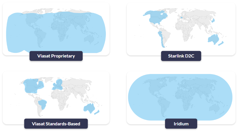
Starlink’s D2C service will initially be available in the USA, Canada, Australia, New Zealand, Japan, Switzerland, Chile and Peru (source). So, if your IoT application is not in one of these countries, you’ll need to look elsewhere.

For 100% global coverage, including the polar regions, have a look at Iridium which has the only truly global IoT network in operation. If your project is not in the far North or South of the globe, Viasat (pictured) is a great choice. Globalstar has great coverage over North and South America, China and most of Africa and Europe.

1-Inmarsat-Coverage-Map

2. Data Rates

Here we’re not just considering how much data you need to send, but how you need to send it. The most efficient way to communicate with satellites is to use a message-based service, which is what Swarm offered. It’s cost-effective and uses very little power. However, it does generally require some engineering work on your part to manipulate your sensor data into this format.

If you have the ability to do this, check out the following services:


If you have a chatty application, and need to use IP data delivery, Starlink D2C is worth investigating (if/when available in your country / area of operation). Iridium Certus 100 is IP-based (22/88 Kbps), as is Viasat’s IoT Pro (formerly BGAN M2M). Because using IP data delivery is less efficient, it is often more expensive and power-hungry, so also explore whether your satellite IoT device supports edge computing, as this can help throttle back on airtime costs.

3. Latency

Latency refers to the length of time it takes for the data to leave the satellite IoT device, reach the satellite, come back down to the ground station, and be delivered to your server. One of the factors influencing this is the satellite orbit height; satellites in Low Earth Orbit (LEO) have a lower latency than satellites in Geostationary Orbit (GEO).

Latency for different satellite orbit heights diagram

That said, just because a satellite network is in LEO does not mean it will be quick to send and receive data, because the other factor is how frequently a satellite passes overhead. If your satellite network only has a handful of satellites in operation, it may be several hours, even a day, before your data is successfully transmitted. Swarm, despite having approximately 175 satellites in operation before it was disbanded, had big coverage gaps, which led to it having an average message delivery time of 39 minutes and 44 seconds.

This may not matter for your application. If you can manage taking receipt of your data a few times a day rather than in close to real-time, there are several new satellite networks that are worth investigating – among them Sateliot and OQ Technologies.

If you have a latency-sensitive application, an established satellite network in LEO is likely your best bet; Iridium or Starlink’s D2C service, for example. You could also experiment with changing timeout values on network requests to allow for higher latencies, caching more data, or using overlapping network requests and responses where possible (source). SD-WAN solutions can also be deployed to create hierarchical classes of service, and for TCP optimization (if TCP/IP is the preferred means of data delivery). This could unlock the GEO networks, such as Viasat, which are often more cost-effective than their LEO counterparts.

4. Power

Satellite connectivity is generally only the primary means of communication if there’s no cellular infrastructure in place – .e.g. oceans, deserts, mountains, forests and farmlands. Sensors deployed in these locations often also lack mains power, and are not easy to access.

For example: data buoys; hydrology stations; environmental monitoring; livestock monitoring; wind and solar farms and oil and gas pipelines.

IoT Use Cases for Satellite

In these instances, you need to look for solutions optimized for low power. Right now, that most likely means a message-based service using Iridium (IMT or SBD), Viasat (IoT Nano) or Globalstar’s satellite networks. In the next few years, Viasat and Iridium will start to offer standards-based solutions which will likely be lower cost, while still requiring very little power to operate. The great news is that proprietary technologies have started to come down in price in response to the advent of standards, so there’s no need to put your project on hold!

If your application has a power source – trucks, trains and heavy machinery, for example, or a remote outpost that has multiple solar panels – then you should take a look at Starlink’s D2C service, as it is expected to be competitively priced while moving (by IoT standards!) high volumes of data.

How to Choose

Choosing the best satellite network for your IoT application requires careful consideration of factors like location, data rates, latency, and power requirements. While Starlink’s D2C technology offers impressive data speeds and low latency, it may not be the ideal solution for all IoT deployments, especially those constrained by power or located outside the initial coverage areas.

Alternatives like Iridium, Viasat, and Globalstar provide various options, from message-based services ideal for low-power environments to IP-based solutions for higher data throughput. Ultimately, the right choice depends on your specific needs, and consulting with an expert can help ensure you pick the best network for your application.

Speak to an Expert

At Ground Control we’ve been solving remote connectivity challenges for over 20 years. We design and build our own hardware, and work with multiple satellite network operators and standards to ensure our customers get the right solution for their specific needs.

If you have an IoT or tracking application that’ll travel beyond cellular coverage, we’re happy to provide objective, expert advice. Email hello@groundcontrol.com or complete the form, and we’ll be in touch within one working day.

Please enable JavaScript in your browser to complete this form.
Name
Privacy Policy

Developing Video Capability

In today’s interconnected world, the ability to monitor and manage assets remotely has become not just a convenience but a necessity. From sprawling agricultural fields and remote unmanned industrial sites, to vast stretches of pipeline and border control areas, the challenges of ensuring security, efficiency, and productivity in remote, often environmentally challenging locations, are ever-present.

Integrating advanced video surveillance technologies with satellite connectivity is revolutionizing how industries approach these challenges. Ground Control’s recent partnership with Videosoft exemplifies this transformation, bringing real-time, low-bandwidth video streaming over satellite to the forefront of remote off-grid operations.

This article delves into the transformative impact of satellite-enabled video surveillance across three critical applications: preventing remote solar panel theft and protecting parked vehicles like quadbikes, all-terrain vehicles (ATV) and heavy vehicles; leveraging aerial video footage over satellite for agricultural and forestry monitoring; and enhancing remote border control operations.

1. Safeguarding Remote Assets

Solar panels are increasingly being deployed in remote, often unmonitored locations as renewable energy installations proliferate. PV installations for solar farms and solar as a power source in remote industries present an increasing global opportunity for crime.

The attractiveness of solar panels to thieves is primarily because of their high value and the perceived ease of theft, especially from remote, poorly secured installations. Europe reports over 5,000 major solar thefts annually, with southern Italy experiencing rates ten times the European average. The problem is global; in Nigeria and South Africa, solar panel theft is stifling renewable energy growth.

Remote-farm-with-solar-panels

Similarly, in industries like mining, agriculture, and construction, frequently stationed valuable vehicles and equipment, such as ATVs (all-terrain vehicles) or heavy vehicles, in isolated areas are at risk. These assets are prime targets for theft and vandalism due to their high value and minimal on-site security. The UK agricultural sector alone saw an estimated £49.5 million in stolen equipment in 2023.

There are known illicit global markets for farming and technology equipment, where criminals can sell their stolen wares for much higher prices. This specific type of theft has been triggered by soaring values, particularly in relation to metals and machinery and the low supply of farm machinery worldwide.

Heavy-machinery

The Problem With Off-Grid Locations

While traditional camera surveillance methods provide a deterrent to criminal activity, they often rely on cellular networks which may not be available in remote locations. The network gap leaves off-grid assets vulnerable, with limited options to monitor and protect investments effectively and cost efficiently.

The Solution: Video Compression Over Satellite

Integrating Videosoft’s high-compression, low-latency, off-grid video streaming technology into Ground Control’s RockREMOTE Rugged device offers a robust solution. This facilitates real-time video surveillance over the Iridium satellite network, ensuring continuous monitoring even when there is zero cellular network availability.

Deploying a remote video monitoring strategy means action can be taken before a crime occurs. Video compression ensures quality image capture, and with RockREMOTE’s powerful edge computing capabilities, multiple sensor connection options, and real-time connectivity, it can detect certain events, like a person loitering after hours or jumping a fence. Follow-on actions can be automated or taken remotely, server-side, to deter a potential criminal’s next steps. By activating specific deterrents, like recorded announcements, alarms, and flashing lights, asset protection management can respond from anywhere in real-time to prevent a potential crime.

The cost-effectiveness of this solution lies in its data efficiency. By compressing video at the edge, data transmission costs are minimized without compromising the quality of the recording, making high-quality real-time surveillance financially viable over the Iridium satellite link.

2. Revolutionizing Forestry Monitoring

Agriculture, environmental and forestry monitoring can often span vast, remote areas, making it challenging to monitor crop health, forest conditions, or illegal logging. Drones have emerged as a powerful tool for aerial surveillance, but their reliance on local storage or cellular networks for data transmission limits their efficacy in remote regions.

Drones are also restricted in the altitude at which they can fly, limiting their coverage for each flight. They are ideal for short-range, lower-altitude video capture, but they have range and battery life constraints, and many do not offer the zoom options available from an aircraft. Aircraft can transmit video over much longer distances and cover vast areas unaffected by obstacles in the terrain.

Forestry-operations

However, sending video in real-time over satellite has been expensive, often reserved for emergency services and search and rescue operations. Yet, the need for accurate imagery, delivered cost effectively, in real-time, is increasingly critical in remote land surveillance and monitoring.

The Problem of Deforestation

In North America, illegal logging costs over $1 billion annually, with the U.S. Forest Service estimating $100 million in losses from public lands alone. Romania faces similar challenges, losing valuable primeval forests to illegal logging. New technology to combat these types of losses can’t come quick enough. A new report says deforestation globally increased by 4% in 2022 compared with 2021, with the loss of over 6.6 million hectares of forest. Although there was a decrease of 18% in tropical Asian countries, the world is now 21% off track to eliminate deforestation by 2030.

The Solution: Aerial Video Recording Operations

The encouraging part of Ground Control’s collaboration with Videosoft is that aircraft equipped with cameras to stream live footage can drive real-time insight while keeping aerial transmission costs down. RockREMOTE Rugged, combined with Videosoft’s compression technology, ensures efficient transmission of high-definition video over the Iridium Certus IP connection. Operators can remotely adjust camera focus, zoom, and capture high-resolution video for detailed analysis in real time, whether from the plane or the ground. Access to live feeds enables instant assessment, issue identification, and monitoring, facilitating real-time responses.

The RockREMOTE’s LTE failover feature switches between cellular and satellite networks as needed, maintaining the efficient video transfer and minimizing data costs. With aerial video over satellite, monitoring for illegal logging or assessing the health of farmland or forest canopy becomes significantly more manageable.

3. Enhanced Border Security

Border regions, especially those spanning vast and inhospitable terrains, pose significant challenges for security agencies. Monitoring these areas to prevent illegal crossings, trafficking, or other illicit activities is difficult, mainly due to the hostile terrain, remoteness, and sheer expanse. Traditional surveillance infrastructure is often impractical due to the need for cellular connectivity or the high costs of establishing and maintaining such systems.

Many factors influence the off-grid solution: the degree of threat posed by unsanctioned activity, the conditions for monitoring equipment and transportation, the ruggedness of the terrain, local data and available power supply.

RockREMOTE Rugged with Videosoft illustration

The Solution: Satellite-Enabled Surveillance

From RF spectrum monitoring, to Thermal imaging, RockREMOTE Rugged’s broad range of connection interfaces and containerized edge computing capability enable it to operate with other key security sensors, cameras and applications. The system supports simultaneous live streaming from multiple cameras, providing comprehensive border coverage.

Further, RockREMOTE Rugged’s antenna is omni-directional, with no pointing required; ideal for fixed deployment in hilly or woody locations, or for on-the-move applications. It will also connect from a mobile surveillance unit.

Beyond Surveillance: The Broader Implications

The applications discussed represent a fraction of the potential unlocked by integrating advanced video compression technology with satellite connectivity. From conservation efforts and monitoring endangered species, to reducing remote off-grid crime, the possibilities are vast. Whether it’s safeguarding remote solar installations, leveraging aerial surveillance to protect forests, or enhancing the security of national borders, the ability to transmit real-time, high-quality video over satellite networks is a game-changer. As industries continue to operate in increasingly remote and challenging environments, such innovations are not just advantageous—they are essential.

Would you like to know more?

With over 20 years of satellite experience, the Ground Control team is well placed to help you keep an eye on the things that matter most.

Whatever your remote surveillance needs, we can help. Complete the form to be connected to one of our team to discover more about the innovative video software, RockREMOTE Rugged and how our solutions can support your project.

Please enable JavaScript in your browser to complete this form.
Name
Privacy Policy

Viasat has officially launched a redefined and expanded product portfolio following its recent acquisition of Inmarsat. The new lineup is designed to simplify their satellite IoT and asset tracking solutions, combining the technical expertise and global reach of both companies. With the consolidation of services, Viasat aims to deliver a more integrated, customer-centric suite of solutions for businesses in industries ranging from logistics to energy, all while streamlining its product range.

What’s New in Viasat’s Product Portfolio?

With the reimagined suite of services, Viasat has focused on making it easier for companies to navigate their satellite communication needs. The new portfolio has been carefully organized around key industry applications, including satellite IoT, asset tracking, remote surveillance, and mission-critical communications.

By simplifying its offerings, Viasat allows businesses to quickly identify the right solution, whether it’s for fleet management, environmental monitoring, or operations in remote, hard-to-reach areas. While the shift may feel like a departure from Inmarsat’s familiar product names, the rebrand is geared toward enhancing the user experience with more clarity and convenience.

viasat portfolio-wheel

Key Changes to Viasat’s Product Series

Viasat’s rebranded product suite is built with a focus on usability and modern industry demands. Here’s a look at the most significant changes:

IsatData Pro (IDP) → IoT Nano

Connection Type: Message-based
Transmit: 6400 bytes, Receive: 10,000 bytes

Previously a flagship service under Inmarsat, IsatData Pro has been rebranded as IoT Nano. This solution offers low-power, long-life monitoring for remote assets, particularly useful in industrial IoT, fleet tracking, and environmental monitoring sectors. IoT Nano is optimized for minimal data transmission and is ideal for applications that require reliable connectivity in areas with limited infrastructure.


BGAN M2M → IoT Pro

Connection Type: IP-based
Transmit: 448Kbps Receive: 464 Kbps

BGAN M2M, known for delivering high-reliability machine-to-machine (M2M) or direct-to-device (D2D) communications via satellite, is now known as IoT Pro. This rebranded service provides businesses in industries such as oil and gas, utilities, and transportation with uninterrupted connectivity, even in the most extreme conditions. IoT Pro is perfect for enabling critical data flows between remote devices and centralized systems.

viasat portfolio-iot

BGAN → Go-anywhere Pro

Connection Type: IP-based
Transmit: 492Kbps up and down (Standard), 800Kbps for video

The Broadband Global Area Network (BGAN), a trusted service for providing high-speed broadband from virtually any location on Earth, is now renamed Go-anywhere Pro. This solution is tailored for mobile teams, emergency response units, and industries requiring reliable internet connectivity in areas lacking terrestrial networks. Whether you’re in a disaster zone, on an offshore platform, or in remote wilderness, Go-anywhere Pro ensures you’re always connected.

viasat portfolio-go-anywhere

What Does This Mean for Existing Customers?

These changes reflect Viasat’s commitment to delivering a more intuitive and cohesive satellite communication experience. By integrating Inmarsat’s renowned services with Viasat’s cutting-edge technologies, the company provides more powerful, streamlined solutions to meet the needs of various industries.

For businesses currently using Inmarsat services, the transition will be smooth and seamless. Existing services will automatically migrate to the new Viasat-branded solutions without service interruptions, ensuring that all operations remain unaffected.

Ground Control: Your Trusted Partner in Satellite Communications

As an Inmarsat/Viasat Elevate Partner with over 20 years of experience, Ground Control is uniquely positioned to offer customers the best in satellite communication solutions. We provide unmatched flexibility and access to the most competitive rates for airtime and service plans.

Viasat-Logo-Square

Get in touch

Whether you’re managing a fleet, monitoring assets in remote locations, or supporting a critical communications mission, Ground Control can help you find the right package of airtime to suit your unique requirements.

Get in touch to discuss how we can support your satellite communication needs and find the right airtime package for your project.

Please enable JavaScript in your browser to complete this form.
Name
Privacy Policy